Latitude: 53.2808 / 53°16'50"N
Longitude: -2.4362 / 2°26'10"W
OS Eastings: 371015
OS Northings: 376064
OS Grid: SJ710760
Mapcode National: GBR CZFH.CN
Mapcode Global: WH996.KS4S
Plus Code: 9C5V7HJ7+8G
Entry Name: The Smoker Inn
Listing Date: 5 March 1959
Grade: II
Source: Historic England
Source ID: 1139524
English Heritage Legacy ID: 58550
ID on this website: 101139524
Location: Cheshire East, Cheshire, WA16
County: Cheshire East
Civil Parish: Plumley
Traditional County: Cheshire
Lieutenancy Area (Ceremonial County): Cheshire
Church of England Parish: Lower or Nether Peover St Oswald
Church of England Diocese: Chester
Tagged with: Inn Thatched pub
SJ 77 NW PLUMLEY C.P. MANCHESTER ROAD
6/55 The Smoker Inn
5.3.59
- II
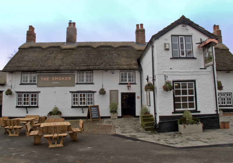
Public house. C17 with C18, C19 and C20 additions and alterations. Rendered and whitewashed brick with stone slate and thatch roof. 2 storeys. Entrance front: projecting wing to right of centre (perhaps originally a porch wing) with decorated brick band of 3 bricks depth between floors. C19 windows to ground and first floor of gable end. To left of projecting wing is a C19 doorway and 2 C20 bow-windows supported on brackets. C19 outshut to far left. Three C20 casement windows to first floor. One late C17 chimney to ridge and 2 C19 chimneys. To right of wing are 2 C20 3-light ground floor casement windows with one 2-light window to first floor.
Listing NGR: SJ7101576064
External links are from the relevant listing authority and, where applicable, Wikidata. Wikidata IDs may be related buildings as well as this specific building. If you want to add or update a link, you will need to do so by editing the Wikidata entry.


Other nearby listed buildings