Approximate Location Map
Large Map »
Latitude: 54.5643 / 54°33'51"N
Longitude: -1.3135 / 1°18'48"W
OS Eastings: 444488
OS Northings: 518997
OS Grid: NZ444189
Mapcode National: GBR MH8N.FM
Mapcode Global: WHD6Y.SJQT
Plus Code: 9C6WHM7P+PJ
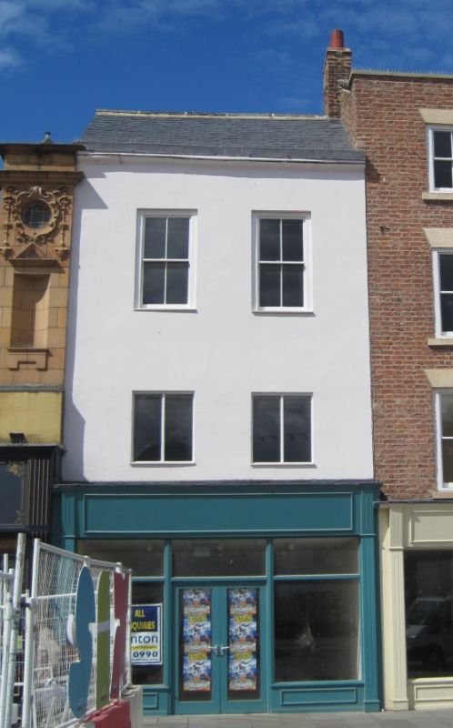
Entry Name: 127, High Street
Listing Date: 21 June 1985
Grade: II
Source: Historic England
Source ID: 1139943
English Heritage Legacy ID: 59475
ID on this website: 101139943
Location: Stockton-on-Tees, North Yorkshire, TS18
County: Stockton-on-Tees
Electoral Ward/Division: Stockton Town Centre
Parish: Non Civil Parish
Built-Up Area: Stockton-on-Tees
Traditional County: Durham
Lieutenancy Area (Ceremonial County): County Durham
Church of England Parish: Stockton-on-Tees
Church of England Diocese: Durham
Tagged with: Building
NZ 4418 NW STOCKTON ON TEES HIGH STREET
(west side)
29/95
No 127
GV II
Late C18 with alterations. Brick with slate roof. Three storeys. Modern
windows and shop front.
Listing NGR: NZ4448818997
External links are from the relevant listing authority and, where applicable, Wikidata. Wikidata IDs may be related buildings as well as this specific building. If you want to add or update a link, you will need to do so by editing the Wikidata entry.


Other nearby listed buildings
