Latitude: 50.3364 / 50°20'11"N
Longitude: -5.111 / 5°6'39"W
OS Eastings: 178711
OS Northings: 53127
OS Grid: SW787531
Mapcode National: GBR Z9.SYC2
Mapcode Global: FRA 0854.QNT
Plus Code: 9C2P8VPQ+HH
Entry Name: Wheal Anna House
Listing Date: 31 October 1988
Grade: II
Source: Historic England
Source ID: 1141544
English Heritage Legacy ID: 63683
ID on this website: 101141544
Location: Goonhavern, Cornwall, TR4
County: Cornwall
Civil Parish: Perranzabuloe
Traditional County: Cornwall
Lieutenancy Area (Ceremonial County): Cornwall
Church of England Parish: Perranzabuloe
Church of England Diocese: Truro
Tagged with: House
PERRANZABULOE SW 75 SE 5/41 Wheal Anna House - II
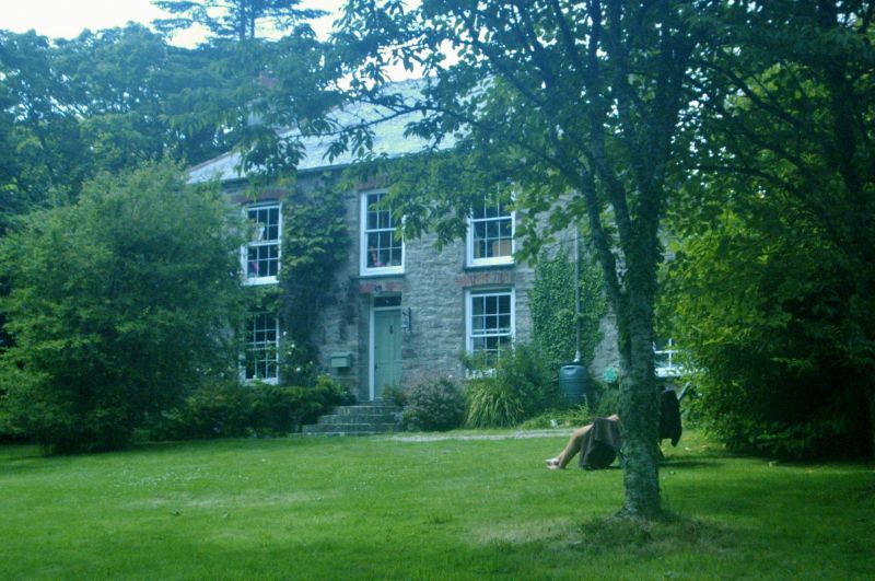
Former count (account) house for Wheal Anna (mine) now a private house. Circa 1840s or 1850s. Built for a mine captain. Killas rubble. Grouted scantle slate hipped roof with brick chimneys over the side walls. Plan: Double-depth plan with 2 rooms at the front flanking a central entrnce hall leading to stair hall between rear service rooms. The 2 front rooms on the first floor are divided by a folding partition (now fixed) which could be opened to create a meeting room for the mine management. Exterior: 2 storeys. Unaltered elevations. Symmetrical 3-window south front with original door and windows in openings spanned by shallow segmental brick arches. Central doorway with 4-panel door and overlight. 12-pane hornless sashes. Similar window at rear including tall stair window. Interior: Virtually unaltered with most of its original features including: dog-leg stair; panelled doors, and chimney-pieces with iron grates. Wooden screen between front chambers (see plan).
Listing NGR: SW7871153127
External links are from the relevant listing authority and, where applicable, Wikidata. Wikidata IDs may be related buildings as well as this specific building. If you want to add or update a link, you will need to do so by editing the Wikidata entry.


Other nearby listed buildings