Approximate Location Map
Large Map »
Latitude: 50.2243 / 50°13'27"N
Longitude: -5.1989 / 5°11'56"W
OS Eastings: 171923
OS Northings: 40935
OS Grid: SW719409
Mapcode National: GBR Z4.QZCG
Mapcode Global: FRA 080F.DF2
Plus Code: 9C2P6RF2+PC
Entry Name: Boundary Stone on West Side of Track at SW 719 409
Listing Date: 12 September 1989
Grade: II
Source: Historic England
Source ID: 1142612
English Heritage Legacy ID: 66770
ID on this website: 101142612
Location: Trevarth, Cornwall, TR16
County: Cornwall
Civil Parish: Lanner
Built-Up Area: Lanner
Traditional County: Cornwall
Lieutenancy Area (Ceremonial County): Cornwall
Church of England Parish: St Day
Church of England Diocese: Truro
Tagged with: Boundary marker
LANNER CARN MARTH
SW 74 SW
6/214
Boundary stone on west side
of track at SW 719 409
GV
II
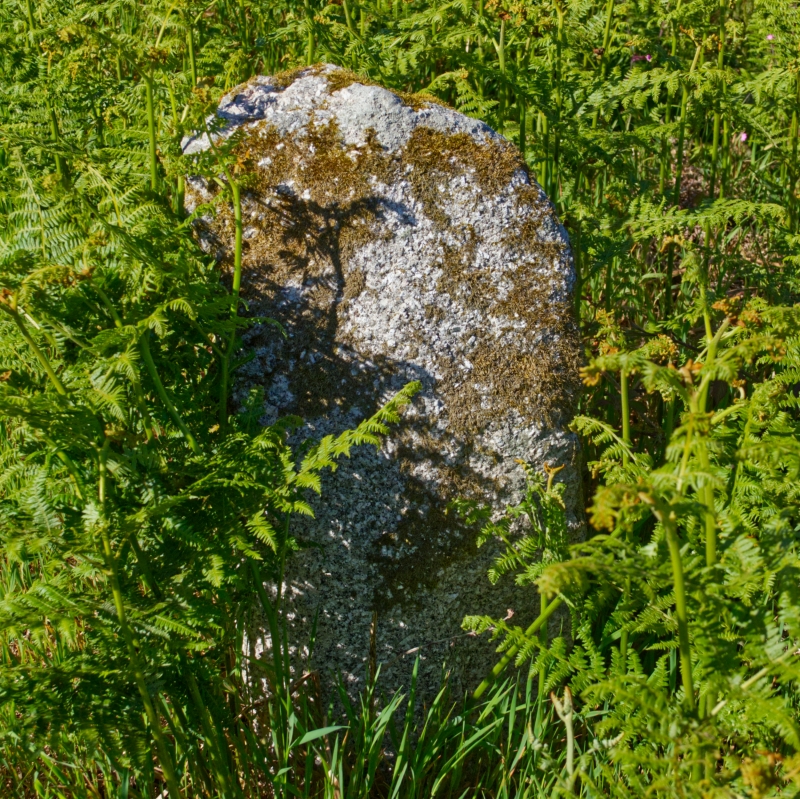
Boundary stone, probably defining mineral rights. Probably early C19. Roughly
hewn granite monolith of irregular shape, approx. ½ metre high, the face
inscribed with the letter "T". Similar to boundary stone at Higher Trevethan,
Carharrack CP (q.v.)
Listing NGR: SW7192340935
External links are from the relevant listing authority and, where applicable, Wikidata. Wikidata IDs may be related buildings as well as this specific building. If you want to add or update a link, you will need to do so by editing the Wikidata entry.


Other nearby listed buildings
