Approximate Location Map
Large Map »
Latitude: 50.14 / 50°8'23"N
Longitude: -5.6506 / 5°39'2"W
OS Eastings: 139248
OS Northings: 33037
OS Grid: SW392330
Mapcode National: GBR DXF9.VXK
Mapcode Global: VH058.0RL2
Plus Code: 9C2P48QX+XP
Entry Name: Boslow Stone 250 Metres North North East of Carnyorth Farm
Listing Date: 19 March 1979
Grade: II
Source: Historic England
Source ID: 1143266
English Heritage Legacy ID: 69219
ID on this website: 101143266
Location: Cornwall, TR20
County: Cornwall
Civil Parish: St. Just
Traditional County: Cornwall
Lieutenancy Area (Ceremonial County): Cornwall
Church of England Parish: Sancreed
Church of England Diocese: Truro
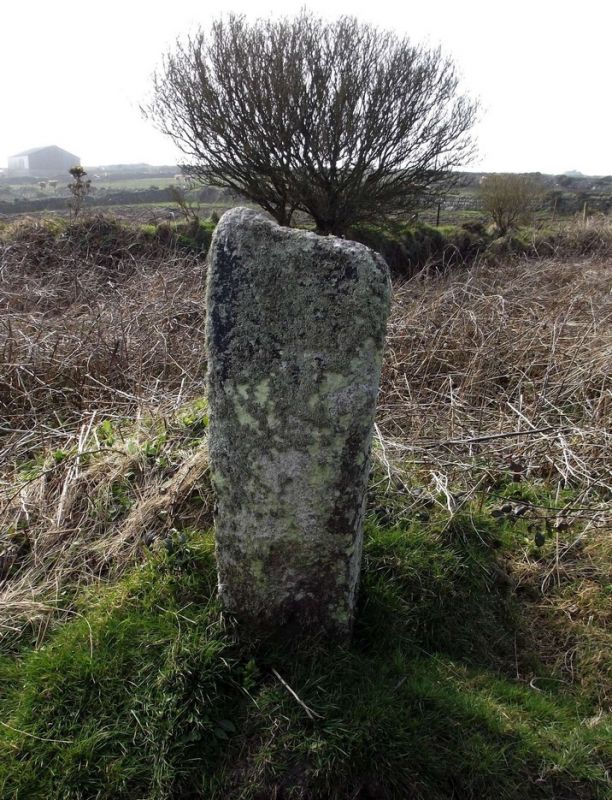
1.
1589 BOTALLACK COMMON
----------------
Boslow stone 250 metres
north-north-east of
Carnyorth Farm
SW 33 SE 1/158
II
2.
Possibly mediaeval. Granite stone about 4' 6" high. Rough hewn with incised latin
cross on one face. Inscriptions read "TAET" and "UREA".
Listing NGR: SW3924833037
External links are from the relevant listing authority and, where applicable, Wikidata. Wikidata IDs may be related buildings as well as this specific building. If you want to add or update a link, you will need to do so by editing the Wikidata entry.


Other nearby listed buildings
