Approximate Location Map
Large Map »
Latitude: 50.2155 / 50°12'55"N
Longitude: -5.4773 / 5°28'38"W
OS Eastings: 152024
OS Northings: 40838
OS Grid: SW520408
Mapcode National: GBR DXV3.PWP
Mapcode Global: VH12F.0VQ6
Plus Code: 9C2P6G8F+53
Entry Name: The Street Surface (Along North-West End Bordering the North of the Harbour)
Listing Date: 22 December 1972
Grade: II
Source: Historic England
Source ID: 1143275
English Heritage Legacy ID: 69148
ID on this website: 101143275
Location: St Ives, Cornwall, TR26
County: Cornwall
Civil Parish: St. Ives
Built-Up Area: St Ives
Traditional County: Cornwall
Lieutenancy Area (Ceremonial County): Cornwall
Church of England Parish: St Ives
Church of England Diocese: Truro
Tagged with: Architectural structure
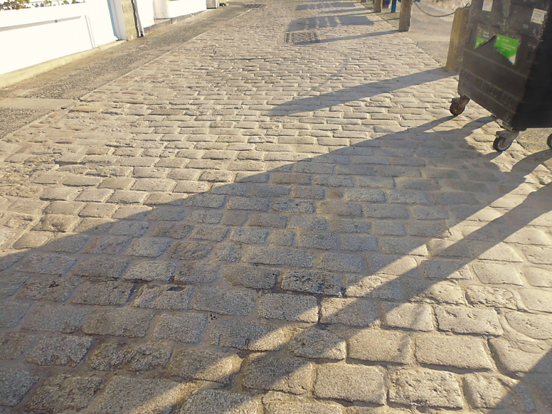
THE WHARF
1. ---------
1587 The Street Surface
(along north-west end
bordering the north of
the harbour)
SW 54 SW 1/297
II
2.
The street Surface of granite blocks along north-west, end of The Wharf
bordering the north of the harbour.
Listing NGR: SW5202440838
External links are from the relevant listing authority and, where applicable, Wikidata. Wikidata IDs may be related buildings as well as this specific building. If you want to add or update a link, you will need to do so by editing the Wikidata entry.


Other nearby listed buildings
