Approximate Location Map
Large Map »
Latitude: 50.2148 / 50°12'53"N
Longitude: -5.4806 / 5°28'50"W
OS Eastings: 151787
OS Northings: 40776
OS Grid: SW517407
Mapcode National: GBR DXV3.NDN
Mapcode Global: VH12D.YVHP
Plus Code: 9C2P6G79+WQ
Entry Name: 7 and 9, Digey Street
Listing Date: 22 December 1972
Grade: II
Source: Historic England
Source ID: 1143367
English Heritage Legacy ID: 68969
ID on this website: 101143367
Location: St Ives, Cornwall, TR26
County: Cornwall
Civil Parish: St. Ives
Built-Up Area: St Ives
Traditional County: Cornwall
Lieutenancy Area (Ceremonial County): Cornwall
Church of England Parish: St Ives
Church of England Diocese: Truro
Tagged with: Building
DIGEY STREET
1. (South-west Side)
1587 -----------------
Nos 7 and 9
SW 54 SW 1/63
II
2.
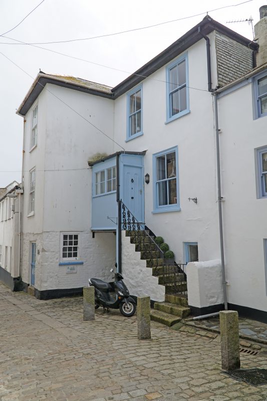
C18/19. Rubble, stuccoed above ground floor. Tall house of three storeys
with projecting wing on left, Three windows overall, sashes in moulded
cases, those on Left have glazing bars. External steps up to first floor
door and modern parch, passage-way underneath. Overhanging eaves.
Slurried slate hipped roof.
Listing NGR: SW5178740776
External links are from the relevant listing authority and, where applicable, Wikidata. Wikidata IDs may be related buildings as well as this specific building. If you want to add or update a link, you will need to do so by editing the Wikidata entry.


Other nearby listed buildings
