Approximate Location Map
Large Map »
Latitude: 50.0746 / 50°4'28"N
Longitude: -5.6226 / 5°37'21"W
OS Eastings: 140900
OS Northings: 25674
OS Grid: SW409256
Mapcode National: GBR DXHH.3BQ
Mapcode Global: VH05N.HDF5
Plus Code: 9C2P39FG+RX
Entry Name: Cross at Approximately 60 Metres South of Church of St Buryan
Listing Date: 15 December 1988
Grade: II
Source: Historic England
Source ID: 1143890
English Heritage Legacy ID: 69698
ID on this website: 101143890
Location: St Buryan, Cornwall, TR19
County: Cornwall
Civil Parish: St. Buryan
Built-Up Area: St Buryan
Traditional County: Cornwall
Lieutenancy Area (Ceremonial County): Cornwall
Church of England Parish: St Buryan
Church of England Diocese: Truro
ST BURYAN ST BURYAN
SW 42 NW
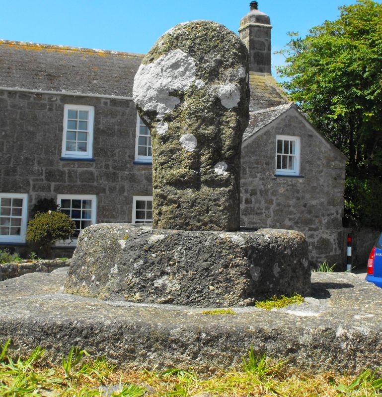
5/146 Cross at approximately 60 metres
- south of Church of St Buryan
GV II
Cross, cross base and surrounding walls. Pre-Conquest cross, circa early C19 walls. Short granite wheel-headed cross set into an octagonal granite base over a square base, all within a large square-on-plan walled base of granite rubble and dressed granite with some reused C17 or earlier fragments. There is a sloping cobbled area between the outer walls and the cross base. Cross has the crucifixion carved on its east face and flared Latin cross to the
opposite face.
Source: Crosses of West Cornwall by Laura Rowe.
Scheduled Ancient Monument 41.
Listing NGR: SW4090025674
External links are from the relevant listing authority and, where applicable, Wikidata. Wikidata IDs may be related buildings as well as this specific building. If you want to add or update a link, you will need to do so by editing the Wikidata entry.


Other nearby listed buildings
