Approximate Location Map
Large Map »
Latitude: 50.3328 / 50°19'58"N
Longitude: -4.758 / 4°45'28"W
OS Eastings: 203813
OS Northings: 51732
OS Grid: SX038517
Mapcode National: GBR N1.XFMX
Mapcode Global: FRA 08X5.45T
Plus Code: 9C2Q86MR+4Q
Entry Name: Bay View
Listing Date: 11 March 1974
Grade: II
Source: Historic England
Source ID: 1144290
English Heritage Legacy ID: 70684
ID on this website: 101144290
Location: Charlestown, Cornwall, PL25
County: Cornwall
Civil Parish: St Austell Bay
Built-Up Area: St Austell
Traditional County: Cornwall
Lieutenancy Area (Ceremonial County): Cornwall
Church of England Parish: Charlestown
Church of England Diocese: Truro
Tagged with: Building
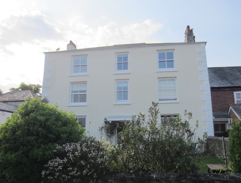
CHARLESTOWN
1. CHARLESTOWN ROAD
1584A (East Side)
No 6 (Bay View)
SX 0351 NE 4/28
II
2.
Early C19. Stucco. Rusticated quoins. Three storeys, three windows,
sashes without glazing bars. Central door, glazed and panelled, open
flat roofed porch with open ironwork columns. Slate hipped roof. Included
for group value.
Listing NGR: SX0381351731
External links are from the relevant listing authority and, where applicable, Wikidata. Wikidata IDs may be related buildings as well as this specific building. If you want to add or update a link, you will need to do so by editing the Wikidata entry.


Other nearby listed buildings
