Latitude: 54.6792 / 54°40'45"N
Longitude: -3.1951 / 3°11'42"W
OS Eastings: 323040
OS Northings: 532229
OS Grid: NY230322
Mapcode National: GBR 6G4B.2D
Mapcode Global: WH6ZS.WNQ6
Plus Code: 9C6RMRH3+MX
Entry Name: Green Farmhouse
Listing Date: 8 August 1985
Grade: II
Source: Historic England
Source ID: 1144581
English Heritage Legacy ID: 72104
ID on this website: 101144581
Location: Bassenthwaite, Cumberland, Cumbria, CA12
County: Cumbria
District: Allerdale
Civil Parish: Bassenthwaite
Traditional County: Cumberland
Lieutenancy Area (Ceremonial County): Cumbria
Church of England Parish: Binsey Team
Church of England Diocese: Carlisle
Tagged with: Farmhouse
NY 23 SW BASSENTHWAITE BASSENTHWAITE
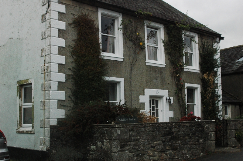
4/20 Green Farmhouse
II
Farmhouse. Dated and inscribed over entrance J. & M.H. 1761. Roughcast walls
with V-jointed quoins on chamfered plinth, under graduated greenslate roof with
ashlar chimney stacks. 2 storeys, 3 bays. C20 door in alternate-block
surround. Sash windows in painted stone architraves. Adjoining outbuildings
are not of interest.
Listing NGR: NY2304032229
External links are from the relevant listing authority and, where applicable, Wikidata. Wikidata IDs may be related buildings as well as this specific building. If you want to add or update a link, you will need to do so by editing the Wikidata entry.


Other nearby listed buildings