Approximate Location Map
Large Map »
Latitude: 54.4379 / 54°26'16"N
Longitude: -2.3521 / 2°21'7"W
OS Eastings: 377256
OS Northings: 504772
OS Grid: NY772047
Mapcode National: GBR DK03.KX
Mapcode Global: WH93M.VQ37
Plus Code: 9C6VCJQX+44
Entry Name: Lammerside Castle
Listing Date: 6 February 1968
Grade: II
Source: Historic England
Source ID: 1145017
English Heritage Legacy ID: 73045
ID on this website: 101145017
Location: Wharton, Westmorland and Furness, Cumbria, CA17
County: Cumbria
District: Eden
Civil Parish: Wharton
Traditional County: Westmorland
Lieutenancy Area (Ceremonial County): Cumbria
Church of England Parish: Kirkby Stephen with Mallerstang and Crosby Garrett with Soulby
Church of England Diocese: Carlisle
Tagged with: Castle
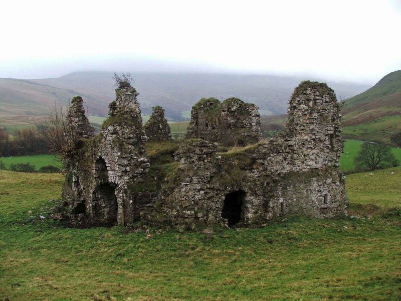
NY 70 SE WHARTON Lammerside Castle
7/84
6.2.68 II
Surviving remains originally formed part of C14 building's central core. Coursed,
squared rubble walls partially robbed. Barrel-vaulted ground floor and some of
1st floor still stands. Scheduled Monument. See R.C.H.M. for detailed description.
Listing NGR: NY7725604772
External links are from the relevant listing authority and, where applicable, Wikidata. Wikidata IDs may be related buildings as well as this specific building. If you want to add or update a link, you will need to do so by editing the Wikidata entry.


Other nearby listed buildings
