Approximate Location Map
Large Map »
Latitude: 54.6775 / 54°40'39"N
Longitude: -3.2427 / 3°14'33"W
OS Eastings: 319966
OS Northings: 532096
OS Grid: NY199320
Mapcode National: GBR 5GSC.R0
Mapcode Global: WH6ZS.5P3H
Plus Code: 9C6RMQH4+2W
Entry Name: Ouse Bridge, Cockermouth, Cumbria
Listing Date: 5 September 1986
Grade: II
Source: Historic England
Source ID: 1145213
English Heritage Legacy ID: 72537
ID on this website: 101145213
Location: Dubwath, Cumberland, Cumbria, CA13
County: Cumbria
District: Allerdale
Civil Parish: Setmurthy
Traditional County: Cumberland
Lieutenancy Area (Ceremonial County): Cumbria
Church of England Parish: Binsey Team
Church of England Diocese: Carlisle
Tagged with: Architectural structure
BLINDCRAKE BASSENTHWAITE LAKE
NY 13 SE
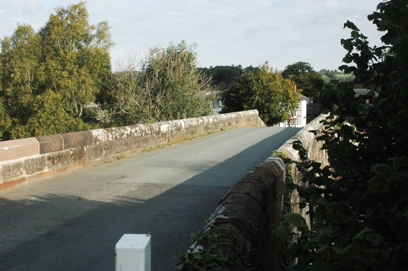
6/12 Ouse Bridge
Cockermouth, Cumbria
II
Roadbridge. Early C19. Calciferous sandstone ashlar with red sandstone ashlar
parapets. 2 segmental arches on piers with splayed cutwaters. Solid chamfered
parapets. OS bench mark in centre of east parapet. This bridge lies partly in
Setmurthy Parish.
Listing NGR: NY1996632096
External links are from the relevant listing authority and, where applicable, Wikidata. Wikidata IDs may be related buildings as well as this specific building. If you want to add or update a link, you will need to do so by editing the Wikidata entry.


Other nearby listed buildings
