Latitude: 52.7821 / 52°46'55"N
Longitude: -0.2021 / 0°12'7"W
OS Eastings: 521361
OS Northings: 322014
OS Grid: TF213220
Mapcode National: GBR HX7.HQZ
Mapcode Global: WHHML.VBYJ
Plus Code: 9C4XQQJX+R5
Entry Name: Pode Hole Pumping Station
Listing Date: 14 August 1978
Grade: II
Source: Historic England
Source ID: 1146964
English Heritage Legacy ID: 198216
ID on this website: 101146964
Location: Pode Hole, South Holland, Lincolnshire, PE11
County: Lincolnshire
District: South Holland
Civil Parish: Pinchbeck
Built-Up Area: Spalding
Traditional County: Lincolnshire
Lieutenancy Area (Ceremonial County): Lincolnshire
Church of England Parish: Spalding St John the Baptist
Church of England Diocese: Lincoln
Tagged with: Pumping station Architectural structure
PINCHBECK PODE HOLE TF 22 SW 10/102 Pode Hole Pumping Station 14.8.78 II
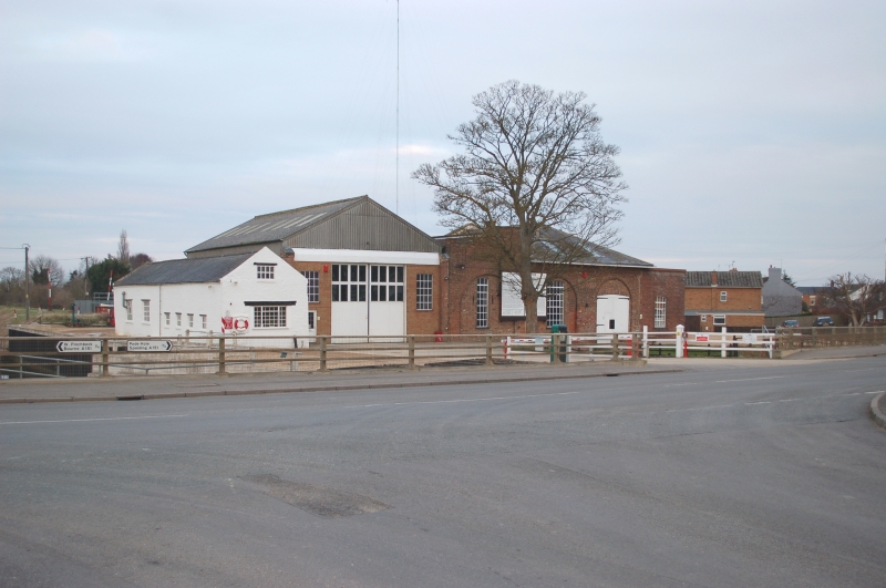
Drainage pumping station. 1825, altered later C19 and C20. Red brick, hipped slate roof with overhanging eaves, now incorporated in later building. Single storey originally 2 bay front with tall semi-circular blank arches now containing a cast iron window to the left and planked double doors to the right. To the left a later C19 bay with semi-circular arch and cast iron windows with ramped ashlar coped parapet. On the front a large painted board with the bye-laws of "Deeping Fen Spalding and Pinchbeck Drainage Board", dated 1876. In front a keystone dated 1866, incorporated into a mounting block, with inscription "Sharps Bridge Keystone".
Listing NGR: TF2136122014
External links are from the relevant listing authority and, where applicable, Wikidata. Wikidata IDs may be related buildings as well as this specific building. If you want to add or update a link, you will need to do so by editing the Wikidata entry.


Other nearby listed buildings