Latitude: 51.6294 / 51°37'45"N
Longitude: 0.6135 / 0°36'48"E
OS Eastings: 580980
OS Northings: 195522
OS Grid: TQ809955
Mapcode National: GBR QN6.ZW6
Mapcode Global: VHJKQ.L95R
Plus Code: 9F32JJH7+Q9
Entry Name: 307, 309 and 311, Ferry Road
Listing Date: 15 February 1980
Grade: II
Source: Historic England
Source ID: 1147814
English Heritage Legacy ID: 122998
ID on this website: 101147814
Location: Brandy Hole, Rochford, Essex, SS5
County: Essex
District: Rochford
Civil Parish: Hullbridge
Built-Up Area: Hullbridge
Traditional County: Essex
Lieutenancy Area (Ceremonial County): Essex
Church of England Parish: Hullbridge St Thomas of Canterbury
Church of England Diocese: Chelmsford
Tagged with: Building
HULLBRIDGE FERRY ROAD TQ 89 NW 1/44 Nos. 307, 309 and 311 15.2.80 GV II
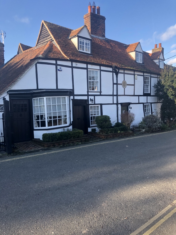
Row of cottages. C18. Timber framed and plastered with some batten decoration. Red plain tiled roof, later hip with gablet to left. Red brick off centre left and gault brick right chimney stacks. Rear ranges. 2 storeys and attics. 3 gabled dormers. 3 window range of vertically sliding sashes, mainly small paned and a small paned bay to ground floor left. 4 doors alternating with ground floor windows, all with moulded surrounds, that to right C20, the others vertically boarded. Second door from left with frieze and flat canopy on brackets, second door from right, with red tiled gabled porch. Plaque over this door with initials S.H. and date 1793.
Listing NGR: TQ8098095522
External links are from the relevant listing authority and, where applicable, Wikidata. Wikidata IDs may be related buildings as well as this specific building. If you want to add or update a link, you will need to do so by editing the Wikidata entry.


Other nearby listed buildings