Approximate Location Map
Large Map »
Latitude: 54.4711 / 54°28'16"N
Longitude: -0.6293 / 0°37'45"W
OS Eastings: 488929
OS Northings: 509282
OS Grid: NZ889092
Mapcode National: GBR SJ1R.K0
Mapcode Global: WHG9Y.9WL7
Plus Code: 9C6XF9CC+C7
Entry Name: 16 and 18 High Street
Listing Date: 4 December 1972
Grade: II
Source: Historic England
Source ID: 1148194
English Heritage Legacy ID: 326864
ID on this website: 101148194
Location: Ruswarp, North Yorkshire, YO21
County: North Yorkshire
District: Scarborough
Civil Parish: Whitby
Built-Up Area: Whitby
Traditional County: Yorkshire
Lieutenancy Area (Ceremonial County): North Yorkshire
Tagged with: Building
This list entry was subject to a Minor Amendment on 27 October 2021 to reformat text to current standards
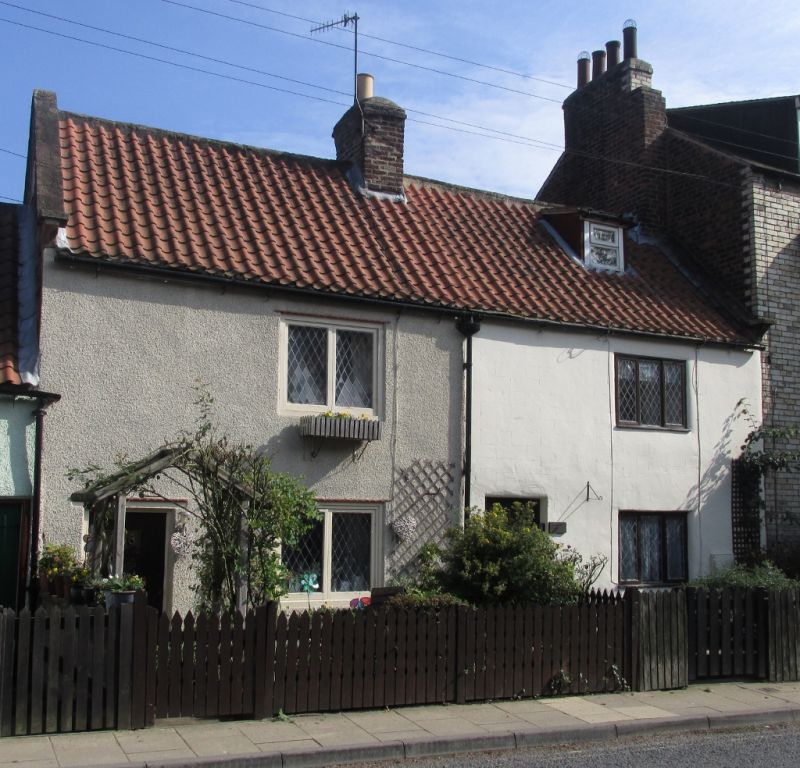
NZ 8809
10/224
RUSWARP
HIGH STREET (East Side)
Nos 16 and 18
II
Early C18. One composition. Two storeys in rubble, rendered. Pantile roof with kneelers. One dormer to No 18. Two three-light wood mullioned windows, modern casements. Six panel door to No 16, modern door to No 18.
Listing NGR: NZ8892909282
External links are from the relevant listing authority and, where applicable, Wikidata. Wikidata IDs may be related buildings as well as this specific building. If you want to add or update a link, you will need to do so by editing the Wikidata entry.


Other nearby listed buildings
