Approximate Location Map
Large Map »
Latitude: 54.4714 / 54°28'17"N
Longitude: -0.6299 / 0°37'47"W
OS Eastings: 488888
OS Northings: 509317
OS Grid: NZ888093
Mapcode National: GBR SJ1Q.FW
Mapcode Global: WHG9Y.9V9Z
Plus Code: 9C6XF9CC+H2
Entry Name: 7 and 9, High Street
Listing Date: 4 December 1972
Grade: II
Source: Historic England
Source ID: 1148232
English Heritage Legacy ID: 326854
ID on this website: 101148232
Location: Ruswarp, North Yorkshire, YO21
County: North Yorkshire
District: Scarborough
Civil Parish: Whitby
Built-Up Area: Whitby
Traditional County: Yorkshire
Lieutenancy Area (Ceremonial County): North Yorkshire
Tagged with: Building
1.
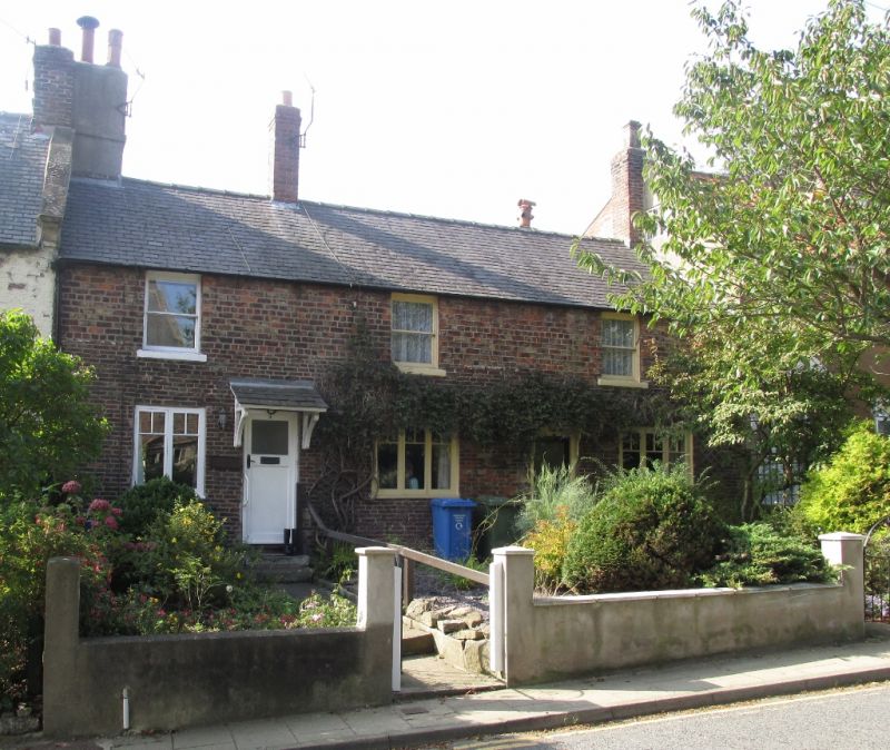
1811 HIGH STREET
(West Side)
RUSWARP
Nos 7 & 9
NZ 8809 10/527
II GV
2.
Early CL9. 2 storeys in brick. Welsh slate roof. 3 windows, no glazing
bars. Ground floor window to No 7 has segmental relieving arch. Pedimented
porch to plain door of No 9.
Nos 1 to 33 (odd) form a group.
Listing NGR: NZ8888809317
External links are from the relevant listing authority and, where applicable, Wikidata. Wikidata IDs may be related buildings as well as this specific building. If you want to add or update a link, you will need to do so by editing the Wikidata entry.


Other nearby listed buildings
