Latitude: 53.8647 / 53°51'52"N
Longitude: -1.1933 / 1°11'35"W
OS Eastings: 453148
OS Northings: 441241
OS Grid: SE531412
Mapcode National: GBR NR3R.GC
Mapcode Global: WHDBH.M4Z3
Plus Code: 9C5WVR74+VM
Entry Name: Gatehouse
Listing Date: 29 January 1980
Grade: II*
Source: Historic England
Source ID: 1148416
English Heritage Legacy ID: 326402
ID on this website: 101148416
Location: Bolton Percy, North Yorkshire, YO23
County: North Yorkshire
District: Selby
Civil Parish: Bolton Percy
Traditional County: Yorkshire
Lieutenancy Area (Ceremonial County): North Yorkshire
Church of England Parish: Bolton Percy All Saints
Church of England Diocese: York
Tagged with: Gatehouse
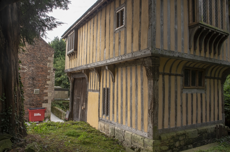
BOLTON PERCY GATEHOUSE LANE SE 54 SW (north side) 4/18 Gatehouse 29.1.80 GV II* * Gatehouse. C15 with later alterations including roof structure and restorations including those of late C20. Timber-framed with rendered infil, rubble and hammer-dressed magnesian limestone plinth and pantile roof with lower 3 courses of stone slates. 2 storeys, 3 bays including central carriage arch, the range to the left side derelict at time of resurvey. Close-studded frame with tension braces. Former entrance to left range has hollow-chamfered, basket-arched opening with carved spandrels. Steps to 2 further C20 fire exits to first floor within probably original openings. Present entrance by C20 studded door to rear. First floor jettied to end and sides with carved dragon posts with brattishing and carved grotesques. Windows are C20 replacements. Jettied gable end. Left range: chamfered plinth to height of 0.75 metres with 3 jowled posts and wall plate with splayed scarf joints standing, tie beam and other timbers lying on ground at time of resurvey. Interior. First floor. Jowled posts and cambered tie beams with hollow chamfers. Arch braces with Tudor rose and other carved motifs. Wall plate shows several splayed scarf joints. Trenched and collar purlin roof. Pevsner N, Yorkshire, the West Riding, 1979, p 117.
Listing NGR: SE5314841242
External links are from the relevant listing authority and, where applicable, Wikidata. Wikidata IDs may be related buildings as well as this specific building. If you want to add or update a link, you will need to do so by editing the Wikidata entry.


Other nearby listed buildings