Latitude: 54.3957 / 54°23'44"N
Longitude: -0.8469 / 0°50'49"W
OS Eastings: 474961
OS Northings: 500635
OS Grid: NZ749006
Mapcode National: GBR QKJM.F1
Mapcode Global: WHF92.YSV2
Plus Code: 9C6X95W3+76
Entry Name: Waymarker
Listing Date: 7 July 1989
Grade: II
Source: Historic England
Source ID: 1148787
English Heritage Legacy ID: 327506
ID on this website: 101148787
Location: North Yorkshire, YO18
County: North Yorkshire
District: Scarborough
Civil Parish: Egton
Traditional County: Yorkshire
Lieutenancy Area (Ceremonial County): North Yorkshire
Church of England Parish: Glaisdale St Thomas
Church of England Diocese: York
Tagged with: Milestone
EGTON ROSEDALE TO EGTON ROAD
NZ 70 SW 749006
(east side)
6/36 Waymarker
GV II
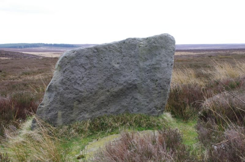
Waymarker. Probably C18. Gritstone. Massive unmasoned slab approxi-
mately 1.40 metre high. OSBM on west face.
Listing NGR: NZ7496100635
External links are from the relevant listing authority and, where applicable, Wikidata. Wikidata IDs may be related buildings as well as this specific building. If you want to add or update a link, you will need to do so by editing the Wikidata entry.


Other nearby listed buildings