Latitude: 54.506 / 54°30'21"N
Longitude: -0.6947 / 0°41'40"W
OS Eastings: 484617
OS Northings: 513077
OS Grid: NZ846130
Mapcode National: GBR RJLB.DJ
Mapcode Global: WHG9X.90FH
Plus Code: 9C6XG844+94
Entry Name: Low Farmhouse
Listing Date: 10 December 1985
Grade: II
Source: Historic England
Source ID: 1148864
English Heritage Legacy ID: 327280
ID on this website: 101148864
Location: Lythe, North Yorkshire, YO21
County: North Yorkshire
District: Scarborough
Civil Parish: Lythe
Traditional County: Yorkshire
Lieutenancy Area (Ceremonial County): North Yorkshire
Church of England Parish: Lythe with Sandsend
Church of England Diocese: York
Tagged with: Farmhouse
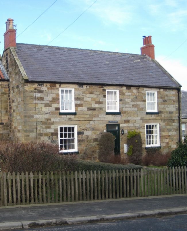
NZ 8413 LYTHE HIGH STREET
(north side) Lythe
13/205
Low Farmhouse
-
GV II
Farmhouse, early C19. Coursed squared stone. Welsh slate roof with stone
copings. End brick chimneys, rebuilt. Two storeys, 3 windows, sashes with
glazing bars. Central 4 panel door under oblong fanlight.
Listing NGR: NZ8461713077
External links are from the relevant listing authority and, where applicable, Wikidata. Wikidata IDs may be related buildings as well as this specific building. If you want to add or update a link, you will need to do so by editing the Wikidata entry.


Other nearby listed buildings