Approximate Location Map
Large Map »
Latitude: 54.1136 / 54°6'48"N
Longitude: -0.9013 / 0°54'4"W
OS Eastings: 471920
OS Northings: 469191
OS Grid: SE719691
Mapcode National: GBR QN4W.N4
Mapcode Global: WHFBF.4V2V
Plus Code: 9C6X437X+CF
Entry Name: The Pyramid and Surrounding Piers
Listing Date: 25 January 1954
Last Amended: 22 June 1987
Grade: I
Source: Historic England
Source ID: 1148971
English Heritage Legacy ID: 329010
ID on this website: 101148971
Location: North Yorkshire, YO60
County: North Yorkshire
District: Ryedale
Civil Parish: Henderskelfe
Traditional County: Yorkshire
Lieutenancy Area (Ceremonial County): North Yorkshire
Church of England Parish: Bulmer St Martin
Church of England Diocese: York
Tagged with: Architectural structure
HENDERSKELFE ST ANNE'S HILL
SE 7169
Castle Howard
12/54 The Pyramid and
surrounding piers
25.1.54 (formerly listed as the
Pyramid on St Anne's
Hill)
GV I
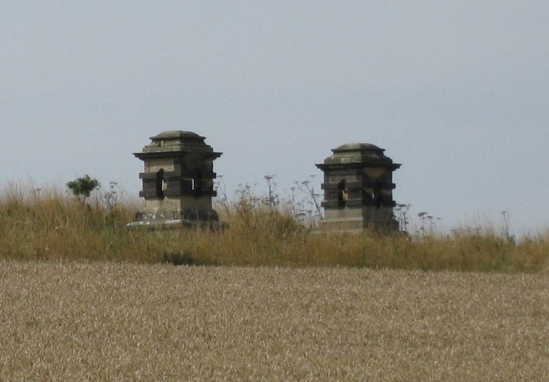
Pyramid and surrounding piers. 1728. By Nicholas Hawksmoor for Charles
Howard, 3rd Earl of Carlisle, in memory of his ancestor Lord William Howard,
the Elizabethan founder of the Carlisle branch of the Howard family.
Limestone. Central pyramid with angled pairs of piers approximately
20 metres from each corner. Pyramid, with sides of approximately 9 metres
stands on low podium with some vermiculated rustication. Piers each have
square base on plinth, with hollow columns pierced by oval apertures which
break a lateral band, surmounted by stepped capital. Interior of Pyramid
contains a large bust of Lord William Howard. Howard G, Castle Howard
Guidebook, 1972. Hussey C, English Gardens and Landscapes 1700-1750, 1967.
HBMC, Register of Parks and Gardens of special historic interest in England,
Part 32, North Yorkshire: Castle Howard, Grade I.
Listing NGR: SE7192069191
External links are from the relevant listing authority and, where applicable, Wikidata. Wikidata IDs may be related buildings as well as this specific building. If you want to add or update a link, you will need to do so by editing the Wikidata entry.


Other nearby listed buildings
