Latitude: 53.9599 / 53°57'35"N
Longitude: -1.5503 / 1°33'1"W
OS Eastings: 429602
OS Northings: 451623
OS Grid: SE296516
Mapcode National: GBR KQMN.47
Mapcode Global: WHC8M.5Q0N
Plus Code: 9C5WXC5X+WV
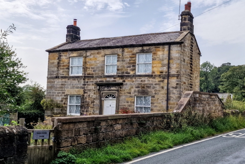
Entry Name: Dawcross Farmhouse
Listing Date: 4 February 1975
Grade: II
Source: Historic England
Source ID: 1149441
English Heritage Legacy ID: 329878
ID on this website: 101149441
Location: Daw Cross, North Yorkshire, HG3
County: North Yorkshire
District: Harrogate
Civil Parish: Pannal and Burn Bridge
Built-Up Area: Pannal
Traditional County: Yorkshire
Lieutenancy Area (Ceremonial County): North Yorkshire
Church of England Parish: Pannal St Robert of Knaresborough
Church of England Diocese: Leeds
Tagged with: Farmhouse
1.
5338
SE 2951
36/46
HILL FOOT ROAD
DAM CROSS, PANNAL
Dawcross Farmhouse
II
2.
Later C18 farmhouse. Grit stone ashlar. Stone slate roof with ridge stack and
stone eaves cornice forming gutter. 2 storeys. Double fronted with 3 windows.
Sill strings. Recessed sash windows. Architraved doorway with panelled frieze
and cornice; semi-elliptical, radial fanlight and 6-panel door.
Listing NGR: SE2960251623
External links are from the relevant listing authority and, where applicable, Wikidata. Wikidata IDs may be related buildings as well as this specific building. If you want to add or update a link, you will need to do so by editing the Wikidata entry.


Other nearby listed buildings