Latitude: 54.2041 / 54°12'14"N
Longitude: -1.162 / 1°9'43"W
OS Eastings: 454761
OS Northings: 479026
OS Grid: SE547790
Mapcode National: GBR NMBT.7Q
Mapcode Global: WHD8S.3LYG
Plus Code: 9C6W6R3Q+J6
Entry Name: The Abbey Gatehouse
Listing Date: 4 January 1955
Last Amended: 11 December 1985
Grade: II
Source: Historic England
Source ID: 1149576
English Heritage Legacy ID: 329582
ID on this website: 101149576
Location: Byland Abbey, North Yorkshire, YO61
County: North Yorkshire
District: Ryedale
Civil Parish: Byland with Wass
Traditional County: Yorkshire
Lieutenancy Area (Ceremonial County): North Yorkshire
Church of England Parish: Coxwold St Michael
Church of England Diocese: York
Tagged with: Gatehouse
BYLAND WITH WASS OLDSTEAD LANE SE 57 NW Byland
4/23 The Abbey Gatehouse (previously 4.1.55 listed together with Byland Abbey) GV II
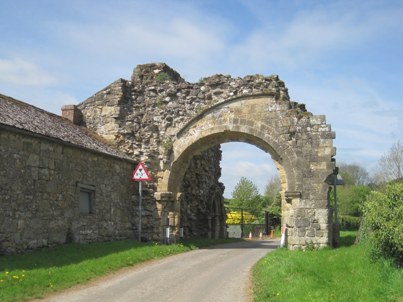
Gatehouse to Byland Abbey (q.v.), now ruinous. Early C13. Limestone ashlar and rubble. Remains of gateway across approach road to abbey, and return wall. Gateway: roll-moulded imposts carrying roll-moulded capitals supporting round arch of 2 hollow-moulded orders with hoodmould. Remains of springer for vault above. Return wall contains pointed doorway of 2 orders with keeled mouldings, now blocked, carried on plain imposts with moulded capitals. This wall is now incorporated into the farm buildings of College Farm (q.v.) which are of no special interest. Pevsner N. "Yorkshire: the North Riding" 1966.
Listing NGR: SE5474979033
External links are from the relevant listing authority and, where applicable, Wikidata. Wikidata IDs may be related buildings as well as this specific building. If you want to add or update a link, you will need to do so by editing the Wikidata entry.


Other nearby listed buildings