Approximate Location Map
Large Map »
Latitude: 54.3426 / 54°20'33"N
Longitude: -0.6683 / 0°40'5"W
OS Eastings: 486674
OS Northings: 494938
OS Grid: SE866949
Mapcode National: GBR RLS7.31
Mapcode Global: WHGBP.P3ZP
Plus Code: 9C6X88VJ+3M
Entry Name: Malo Cross
Listing Date: 5 February 1986
Grade: II
Source: Historic England
Source ID: 1149587
English Heritage Legacy ID: 329620
ID on this website: 101149587
Location: North Yorkshire, YO18
County: North Yorkshire
District: Ryedale
Civil Parish: Lockton
Traditional County: Yorkshire
Lieutenancy Area (Ceremonial County): North Yorkshire
Church of England Parish: Lockton St Giles
Church of England Diocese: York
SE 86819492
4/1
NORTH YORKSHIRE
RYEDALE DISTRICT COUNCIL
ALLERSTON
A169 (east side, off)
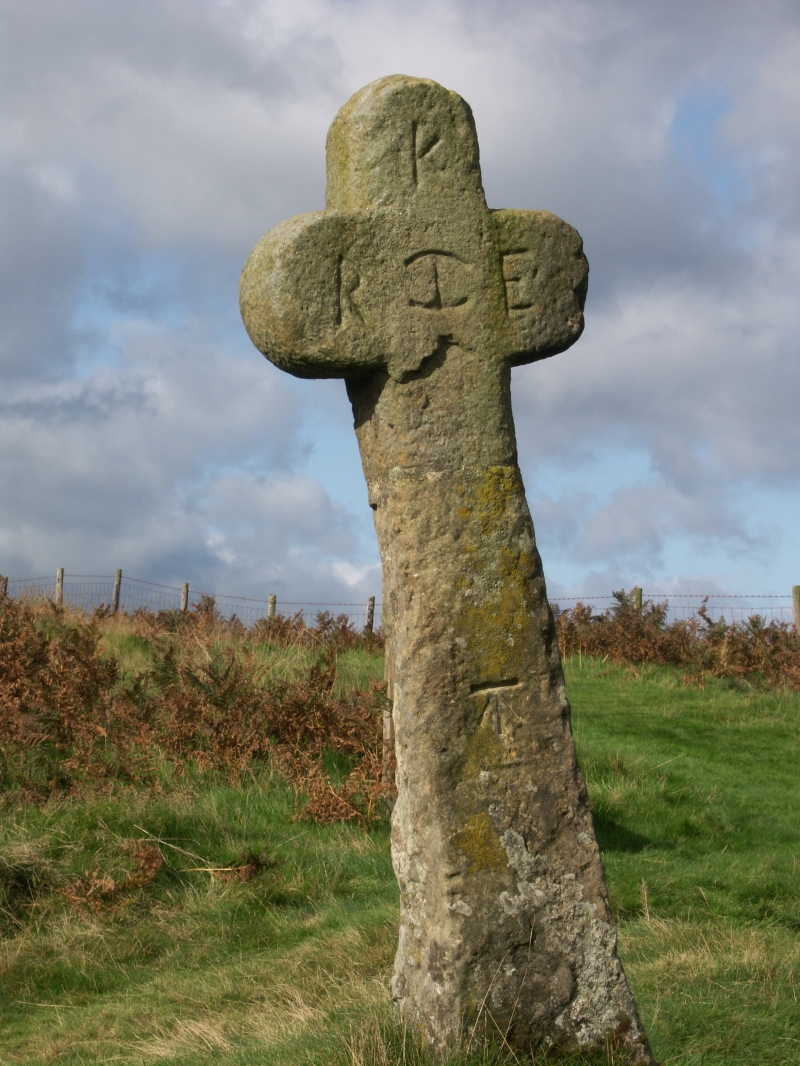
Malo Cross
II
Boundary Cross. c1619. Erected by Sir Richard Egerton. Limestone. Cross approximately 1.75 metres high, with rounded arms. Inscribed on the east face:
K/RIE
J Rushton, The Ryedale Story, 1976, p 137.
Listing NGR: SE8667694938
External links are from the relevant listing authority and, where applicable, Wikidata. Wikidata IDs may be related buildings as well as this specific building. If you want to add or update a link, you will need to do so by editing the Wikidata entry.


