Latitude: 54.0188 / 54°1'7"N
Longitude: -0.9407 / 0°56'26"W
OS Eastings: 469503
OS Northings: 458603
OS Grid: SE695586
Mapcode National: GBR PPWZ.44
Mapcode Global: WHFBZ.J78Z
Plus Code: 9C6X2395+GP
Entry Name: Church of St Leonard's
Listing Date: 29 January 1953
Last Amended: 24 January 1985
Grade: II
Source: Historic England
Source ID: 1149621
English Heritage Legacy ID: 329485
ID on this website: 101149621
Location: St Marys Church, Sand Hutton, North Yorkshire, YO41
County: North Yorkshire
District: Ryedale
Civil Parish: Sand Hutton
Traditional County: Yorkshire
Lieutenancy Area (Ceremonial County): North Yorkshire
Church of England Parish: Sand Hutton St Mary
Church of England Diocese: York
SE 65 NE SAND HUTTON MAIN STREET (north side, off)
5/41 Church of St Leonard's (Formerly listed as Ruined 29 1 53 Chapel of St Leonard) - II
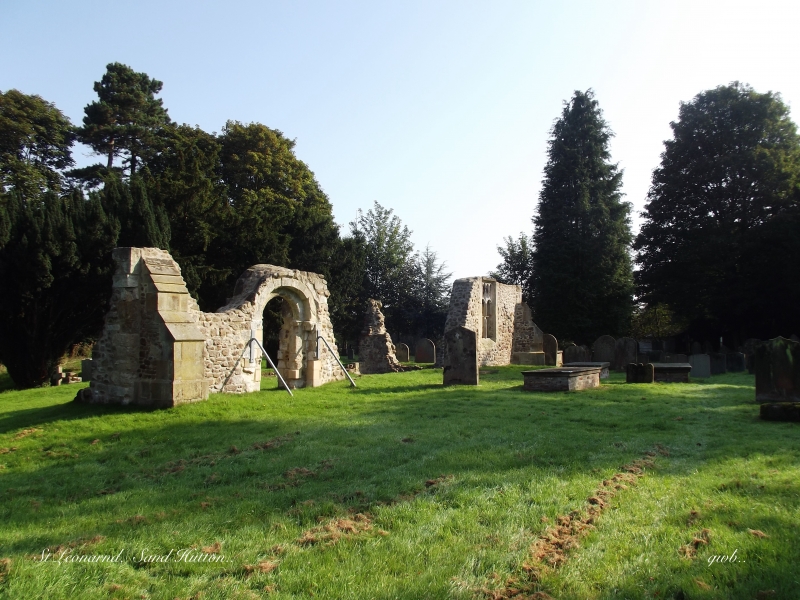
Church, now ruinous. Early C12 south door, C15 chancel and C19 repairs. Rubble and cobbles with limestone and sandstone dressings. Originally 2-bay nave and single-bay chancel. Now standing: round-arched south door with volute capitals and incised sundial to left and section of wall to right containing one 2-light square-headed window with Perpendicular tracery. Vestiges of the east wall remain. Interior: cylindrical font.
Listing NGR: SE6950358603


Other nearby listed buildings