Latitude: 54.0712 / 54°4'16"N
Longitude: -0.6219 / 0°37'18"W
OS Eastings: 490278
OS Northings: 464794
OS Grid: SE902647
Mapcode National: GBR SP3C.5B
Mapcode Global: WHGCW.FX3V
Plus Code: 9C6X39CH+F7
Entry Name: Kirby Grange Farmhouse
Listing Date: 14 December 1987
Grade: II
Source: Historic England
Source ID: 1149693
English Heritage Legacy ID: 329360
ID on this website: 101149693
Location: North Yorkshire, YO25
County: North Yorkshire
District: Ryedale
Civil Parish: Kirby Grindalythe
Traditional County: Yorkshire
Lieutenancy Area (Ceremonial County): North Yorkshire
Church of England Parish: Kirby Grindalythe St Andrew
Church of England Diocese: York
Tagged with: Farmhouse
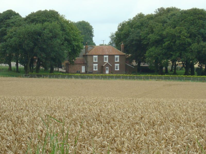
KIRBY GRINDALYTHE B1253 SE 96 SW (north-east side, off) 17/21 Kirby Grange Farmhouse - II Farmhouse. Early C19 with later alteration. Red brick in English garden wall bond with painted sandstone lintels; pantile roof. Central-entrance plan, 2 rooms deep. 2-storey, 3-window front flanked by 1-storey, raked-up screen walls. Original panelled door with divided overlight within later gabled porch with half-glazed door beneath radial fanlight. All windows are 16-pane sashes with painted stone sills and wedge lintels. Stepped eaves band. Base stacks to hipped roof with scrolled corner brackets. Wall at right has blocked opening with wedge lintel and square terminal pier with flat cap. Wall at left largely rebuilt and not of special interest. Rear: 3-light, large-pane horizontal-sliding sashes with cambered wedge lintels and stone sills. Radial-glazed staircase window beneath round arch with imposts. Interior: open-string winder staircase with slender turned balusters, moulded handrail wreathed at foot, and shaped tread-ends. 6-panel doors throughout ground floor.
Listing NGR: SE9027864794
External links are from the relevant listing authority and, where applicable, Wikidata. Wikidata IDs may be related buildings as well as this specific building. If you want to add or update a link, you will need to do so by editing the Wikidata entry.


Other nearby listed buildings