Approximate Location Map
Large Map »
Latitude: 54.3685 / 54°22'6"N
Longitude: -0.8583 / 0°51'29"W
OS Eastings: 474272
OS Northings: 497603
OS Grid: SE742976
Mapcode National: GBR QKFX.ZR
Mapcode Global: WHF98.SGGC
Plus Code: 9C6X949R+CM
Entry Name: Hamer Bridge
Listing Date: 27 August 1987
Grade: II
Source: Historic England
Source ID: 1149718
English Heritage Legacy ID: 382452
ID on this website: 101149718
Location: North Yorkshire, YO18
County: North Yorkshire
District: Ryedale
Civil Parish: Hartoft
Traditional County: Yorkshire
Lieutenancy Area (Ceremonial County): North Yorkshire
Tagged with: Bridge
HARTOFT ROSE DALE TO EGTON BRIDGE
SE 79 NW
ROAD
4/34 Hamer Bridge
II
-
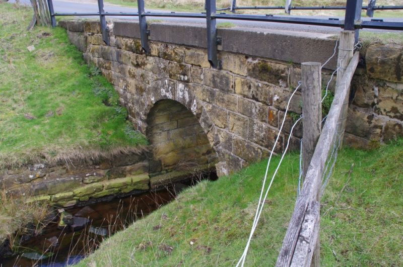
Bridge. Mid-late C18, with C20 renovation. Rusticated and herringbone-
tooled sandstone. Single span. Semicircular arch of voussoirs between
canted abutments. Flat coping replaced at centre by the bed of the modern
road. Timber safety fence in place of parapet. The bridge was a vital link
on the coal and lime trading route between villages to the north and south
of the moors, which flourished from late C18 to early C20.
Listing NGR: SE7427297603
External links are from the relevant listing authority and, where applicable, Wikidata. Wikidata IDs may be related buildings as well as this specific building. If you want to add or update a link, you will need to do so by editing the Wikidata entry.


