Latitude: 54.0684 / 54°4'6"N
Longitude: -1.3908 / 1°23'26"W
OS Eastings: 439966
OS Northings: 463783
OS Grid: SE399637
Mapcode National: GBR LPQD.PB
Mapcode Global: WHD97.LZYY
Plus Code: 9C6W3J95+9M
Entry Name: Milepost 100 Yards South West of Ornhams Grange
Listing Date: 19 December 1984
Grade: II
Source: Historic England
Source ID: 1150128
English Heritage Legacy ID: 330275
ID on this website: 101150128
Location: North Yorkshire, YO51
County: North Yorkshire
District: Harrogate
Civil Parish: Boroughbridge
Traditional County: Yorkshire
Lieutenancy Area (Ceremonial County): North Yorkshire
Tagged with: Milestone
SE 36 SE BOROUGHBRIDGE Al 3/9 Milepost 100 yards south west of Ornhams Grange
II
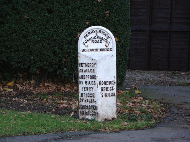
Mile post. Mid C19. Stone with attached iron plate. Round arched. Metal plate has protruding triangular lower section. Painted white with letters in relief reading as follows:- To flat face FERRYBRIDGE AND BOROUGHBRIDGE ROAD BOROUGHBRIDGE; to north face WETHERBY 10 MILES ABERFORD 17½ MILES FERRYBRIDGE 27 MILES; to south face BOROUGHBRIDGE 2 MILES.
Listing NGR: SE3996663782
External links are from the relevant listing authority and, where applicable, Wikidata. Wikidata IDs may be related buildings as well as this specific building. If you want to add or update a link, you will need to do so by editing the Wikidata entry.


Other nearby listed buildings