Latitude: 54.0437 / 54°2'37"N
Longitude: -1.7076 / 1°42'27"W
OS Eastings: 419245
OS Northings: 460896
OS Grid: SE192608
Mapcode National: GBR JPJP.36
Mapcode Global: WHC84.RM1D
Plus Code: 9C6W27VR+FX
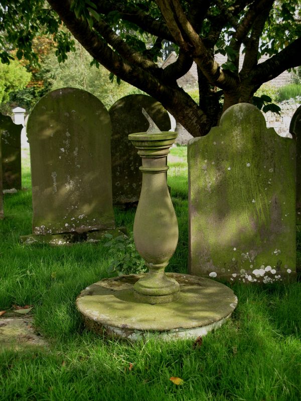
Entry Name: Sundial in Graveyard Approximately 15 Metres South of Providence Chapel
Listing Date: 3 March 1987
Grade: II
Source: Historic England
Source ID: 1150567
English Heritage Legacy ID: 331177
ID on this website: 101150567
Location: Dacre, North Yorkshire, HG3
County: North Yorkshire
District: Harrogate
Civil Parish: Dacre
Traditional County: Yorkshire
Lieutenancy Area (Ceremonial County): North Yorkshire
Tagged with: Sundial
SE 16 SE
8/48
DACRE
MAIN STREET
(east side)
Sundial in graveyard approximately 15 metres south of Providence Chapel
GV
II
Sundial. Dated 1828. Gritstone base and shaft, bronze gnomon. Overall
height approximately 1.2 metres. Circular base, vase baluster with moulded
base (repaired) and roll moulding at neck. Cap separately made, incised
numerals and inscription 'G G 1828'. Probably repositioned. A similar
sundial dated 1826 stands in the churchyard of St Jude's, Hartwith (qv).
Listing NGR: SE1924560896
External links are from the relevant listing authority and, where applicable, Wikidata. Wikidata IDs may be related buildings as well as this specific building. If you want to add or update a link, you will need to do so by editing the Wikidata entry.


Other nearby listed buildings