Latitude: 54.3685 / 54°22'6"N
Longitude: -1.2994 / 1°17'57"W
OS Eastings: 445614
OS Northings: 497228
OS Grid: SE456972
Mapcode National: GBR MKCX.GR
Mapcode Global: WHD7Y.0GHC
Plus Code: 9C6W9P92+C6
Entry Name: Stone Table
Listing Date: 31 January 1970
Last Amended: 11 December 1987
Grade: II
Source: Historic England
Source ID: 1150866
English Heritage Legacy ID: 332491
ID on this website: 101150866
Location: Osmotherley, North Yorkshire, DL6
County: North Yorkshire
District: Hambleton
Civil Parish: Osmotherley
Built-Up Area: Osmotherley
Traditional County: Yorkshire
Lieutenancy Area (Ceremonial County): North Yorkshire
Church of England Parish: Osmotherley St Peter
Church of England Diocese: York
Tagged with: Architectural structure
SE 4497-4597
6/41
31.3.70
OSMOTHERLEY
WEST END
(centre)
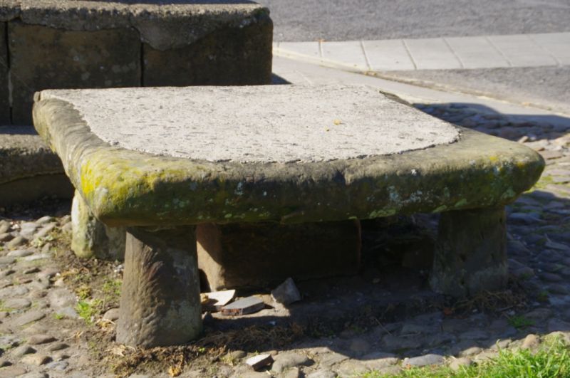
Stone table
(formerly listed as Stone table and Village Cross, Main Street)
GV
II
Stone table. C16. Ashlar. 5 tapered stone supports, approximately 1½ feet
in height, with large stone slab to top.
Listing NGR: SE4561497228
External links are from the relevant listing authority and, where applicable, Wikidata. Wikidata IDs may be related buildings as well as this specific building. If you want to add or update a link, you will need to do so by editing the Wikidata entry.


Other nearby listed buildings