Latitude: 54.3461 / 54°20'45"N
Longitude: -1.5662 / 1°33'58"W
OS Eastings: 428296
OS Northings: 494588
OS Grid: SE282945
Mapcode National: GBR KLH5.QT
Mapcode Global: WHC6V.X1C2
Plus Code: 9C6W8CWM+CG
Entry Name: Lancaster House and Attached Outbuildings
Listing Date: 29 January 1988
Grade: II
Source: Historic England
Source ID: 1150889
English Heritage Legacy ID: 332344
ID on this website: 101150889
Location: Kirkby Fleetham, North Yorkshire, DL7
County: North Yorkshire
District: Hambleton
Civil Parish: Kirkby Fleetham with Fencote
Traditional County: Yorkshire
Lieutenancy Area (Ceremonial County): North Yorkshire
Tagged with: Architectural structure
KIRKBY FLEETHAM LUMLEY LANE SE 29 SE WITfI FENCOTE (north side) 3/60 Lancaster House and attached outbuildings
- II
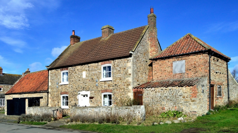
Farmhouse and attached outbuildings. Dated 1797 but with early C18 origins. Rubblestone and red brick, ashlar and red brick dressings, machine tile and pantile roof. Main house: lobby-entry plan. 2 storeys, 2 bays. 1-storey outbuilding to left. 2-storey, l-bay outbuilding set back to right. Main house: ashlar quoins. Central 6-panel door with top 2 panels glazed in quoined surround with raised keystone. Above a tablet inscribed: B T C 1797 Window openings C19. Side-sliding sashes with stone sills and segmental brick arches. Shaped kneelers, stone coping, machine tile roof. End stacks and large central stack. Left-hand outbuilding has 3-double carriage board doors. End stack to left. Right-hand outbuilding has low 1-storey outshut in front of it. Main front is of brick. First floor, a 12-pane side- sliding sash with flat brick arch. Eaves band. Hipped roof.
Listing NGR: SE2829694588
External links are from the relevant listing authority and, where applicable, Wikidata. Wikidata IDs may be related buildings as well as this specific building. If you want to add or update a link, you will need to do so by editing the Wikidata entry.


Other nearby listed buildings