Latitude: 53.5463 / 53°32'46"N
Longitude: -1.4682 / 1°28'5"W
OS Eastings: 435335
OS Northings: 405646
OS Grid: SE353056
Mapcode National: GBR LW5F.YH
Mapcode Global: WHDCX.F426
Plus Code: 9C5WGGWJ+GP
Entry Name: Linking Arcade to Former Barnsley Cemetery Chapels
Listing Date: 20 February 1980
Last Amended: 13 January 1986
Grade: II
Source: Historic England
Source ID: 1151141
English Heritage Legacy ID: 333693
ID on this website: 101151141
Location: Barnsley Cemetery, Measborough Dike, Barnsley, South Yorkshire, S70
County: Barnsley
Electoral Ward/Division: Central
Parish: Non Civil Parish
Built-Up Area: Barnsley
Traditional County: Yorkshire
Lieutenancy Area (Ceremonial County): South Yorkshire
Church of England Parish: Barnsley St Peter and St John the Baptist
Church of England Diocese: Leeds
Tagged with: Arcade
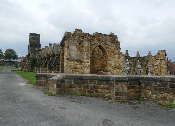
SE30NE BARNSLEY CEMETERY ROAD (south side), 4/84 Barnsley Linking arcade to former Barnsley Cemetery Chapels (formerly listed under Two Barnsley Cemetery 20.2.80 Chapels and linking wall) GV II Linking arcade between 2 former Barnsley cemetery chapels (demolished 1983). 186O-1 by Perkins and Backhouse of Leeds. Coursed squared stone with ashlar dressings. Central pointed arched gateway, gabled with kneelers and a band of circles with trefoils. Trefoil in apex. Reducing angle buttresses with pinnacles. A low Gothic arcade to each side, gabled and divided by reducing buttresses.
Listing NGR: SE3533505646
External links are from the relevant listing authority and, where applicable, Wikidata. Wikidata IDs may be related buildings as well as this specific building. If you want to add or update a link, you will need to do so by editing the Wikidata entry.


Other nearby listed buildings