Latitude: 54.2332 / 54°13'59"N
Longitude: -1.3378 / 1°20'15"W
OS Eastings: 443264
OS Northings: 482151
OS Grid: SE432821
Mapcode National: GBR MM3H.58
Mapcode Global: WHD8H.FV6L
Plus Code: 9C6W6MM6+7V
Entry Name: 15, Ingramgate
Listing Date: 15 June 1984
Grade: II
Source: Historic England
Source ID: 1151317
English Heritage Legacy ID: 333289
ID on this website: 101151317
Location: Thirsk, North Yorkshire, YO7
County: North Yorkshire
District: Hambleton
Civil Parish: Thirsk
Built-Up Area: Thirsk
Traditional County: Yorkshire
Lieutenancy Area (Ceremonial County): North Yorkshire
Tagged with: Building
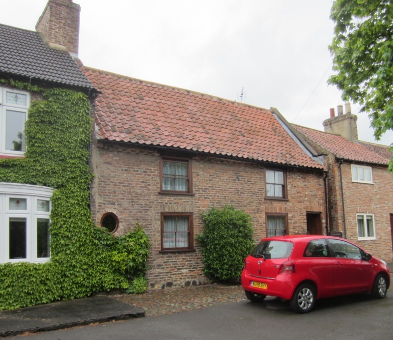
SE 4382 THIRSK INGRAMGATE
7/49 (north side)
No 15
II
Originally a fully timber-framed house of at least 2 bays with an aisle to rear.
Probably late C16. Front and east gable walls of narrow hand-made bricks of early C18
appearance. A single course of large stones at base of front wall. Brick dentilled
eaves. Pantile roof of very steep pitch which is continuous over outshot at rear and has
a parapet at the east gable. 2 storeys in present form. 2 bays. Front: C19 small
sash windows, entrance to right with modern door and blocked entrance to centre. To
the left a roughly oval patch of cement rendering suggesting a blocked oval fire window
of C17 type. Rear: timber frame exposed but disturbed by later building. Interior:
much exposed timber including posts, braces and the beams, an inglenook beam and a
section of wattle-and-daub filling. The roof structure consists of stout common
rafters, pegged at apex and linked by slightly cambered collars about 1/3 of the way
between apex and tie-beam. The rafters over the aisle run from the arcade plate to the
wall plate. B Harrison, Report, 1973, North Yorkshire and Cleveland Vernacular
Buildings Study Group.
Listing NGR: SE4326482151
External links are from the relevant listing authority and, where applicable, Wikidata. Wikidata IDs may be related buildings as well as this specific building. If you want to add or update a link, you will need to do so by editing the Wikidata entry.


Other nearby listed buildings