Latitude: 53.6156 / 53°36'55"N
Longitude: -0.9639 / 0°57'50"W
OS Eastings: 468636
OS Northings: 413721
OS Grid: SE686137
Mapcode National: GBR PVQM.3N
Mapcode Global: WHFDX.5D73
Plus Code: 9C5XJ28P+6C
Entry Name: Tower Mill Immediately to East of Junction with Millfield Road
Listing Date: 29 September 1987
Grade: II
Source: Historic England
Source ID: 1151568
English Heritage Legacy ID: 334684
ID on this website: 101151568
Location: Thorne, Doncaster, South Yorkshire, DN8
County: Doncaster
Civil Parish: Thorne
Built-Up Area: Thorne
Traditional County: Yorkshire
Lieutenancy Area (Ceremonial County): South Yorkshire
Church of England Parish: Thorne St Nicholas
Church of England Diocese: Sheffield
Tagged with: Architectural structure
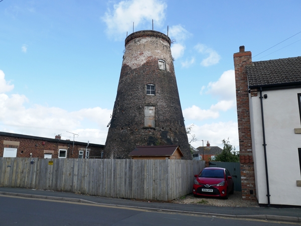
THORNE NORTH EASTERN ROAD SE 6813 (SE 61 SE) (north side) 15/106 Tower mill immediately to east of junction with Millfield Road II Tower mill. Early C19, Tarred red brick. 5-storey, truncated cone. 2 semicircular stone steps to boarded door on south side. Boarded double-doors over with stone ledge and wooden lintel, around the tower at lst-floor level are putlog holes showing position of jettied walkway. Unglazed, segmentally-arched window to 2nd floor, another to 3rd floor set to right. Cogged band to parapet wall now surmounted by brick watertank Right return: blocked segmentally-arched dour beneath window to each floor; Left return: windows on 4 floors. Interior not inspected. Said to have been built in 1815 and known as Oates Mill (Hobson). M. Hobsan, Some notes on Old Thorne, Doncaster Library Service pamphlet, 1985.
Listing NGR: SE6863613721
External links are from the relevant listing authority and, where applicable, Wikidata. Wikidata IDs may be related buildings as well as this specific building. If you want to add or update a link, you will need to do so by editing the Wikidata entry.


Other nearby listed buildings