Approximate Location Map
Large Map »
Latitude: 53.4315 / 53°25'53"N
Longitude: -1.1093 / 1°6'33"W
OS Eastings: 459272
OS Northings: 393113
OS Grid: SK592931
Mapcode National: GBR NXPR.MM
Mapcode Global: WHDDN.X0XP
Plus Code: 9C5WCVJR+H7
Entry Name: 22, 24 and 26, Castlegate
Listing Date: 22 January 1981
Grade: II
Source: Historic England
Source ID: 1151710
English Heritage Legacy ID: 334315
ID on this website: 101151710
Location: Tickhill, Doncaster, South Yorkshire, DN11
County: Doncaster
Civil Parish: Tickhill
Built-Up Area: Tickhill
Traditional County: Yorkshire
Lieutenancy Area (Ceremonial County): South Yorkshire
Church of England Parish: Tickhill St Mary
Church of England Diocese: Sheffield
Tagged with: Building
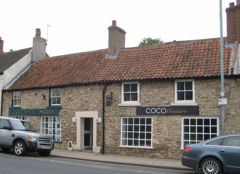
CASTLEGATE
1. (west side)
5096 -----------
Nos 22, 24 and 26
SK 5993 2/69
II GV
2.
1731. Coursed limestone rubble. Pantiled roof. Two storeys. Four bays:
C19 sashes on first floor, modern fixed windows with glazing bars on ground
floor. Door in plain stone architrave. Date plaque. Fire Insurance plaque.
Plaster floor to first floor.
Listing NGR: SK5927293113
External links are from the relevant listing authority and, where applicable, Wikidata. Wikidata IDs may be related buildings as well as this specific building. If you want to add or update a link, you will need to do so by editing the Wikidata entry.


Other nearby listed buildings
