Latitude: 52.4904 / 52°29'25"N
Longitude: 1.1874 / 1°11'14"E
OS Eastings: 616494
OS Northings: 292826
OS Grid: TM164928
Mapcode National: GBR VHV.T6W
Mapcode Global: VHL8P.JNMR
Plus Code: 9F43F5RP+4X
Entry Name: Church of St Peter
Listing Date: 7 December 1959
Grade: I
Source: Historic England
Source ID: 1152619
English Heritage Legacy ID: 225367
Also known as: St Peter’s and St Paul’s, Forncett
St Peters Church, Forncett St Peter
ID on this website: 101152619
Location: St Peter's Church, Forncett St Peter, South Norfolk, NR16
County: Norfolk
District: South Norfolk
Civil Parish: Forncett
Traditional County: Norfolk
Lieutenancy Area (Ceremonial County): Norfolk
Tagged with: Church building
1. 5321 FORNCETT CHURCH ROAD Forncett St Peter Church of St Peter TM 19 SE 8/1 7.12.59
I GV
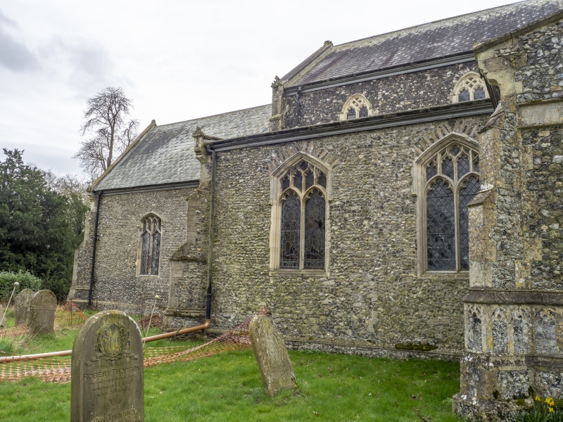
2. C11, C14 and C15. Saxon round west tower with circular openings half way up and near top, 2-light bell-openings with arched and triangular heads and recessed central shafts. Tall nave with clerestory and north and south aisles, with Perpendicular windows. Chancel with some herringbone flushwork and Perpendicular windows. windows. porch with flushwork panelling. Materials: flint with stone dressings and slate roofs. Interior: Three bay arcades, late C14. C15 roof with embattled tiebeams and arched braces. Good bench ends with poppy-heals and figures, possibly C15, restored C19, or wholly 1857 (Pevsner). Jacobean pulpit. C15 octagonal font. Alabaster tomb-chest Thomas Drake 1485 and wife with cusped panelled sides with shields and incised effigies on top slab. The churchyard contains some C18 head stones.
Listing NGR: TM1649492826
External links are from the relevant listing authority and, where applicable, Wikidata. Wikidata IDs may be related buildings as well as this specific building. If you want to add or update a link, you will need to do so by editing the Wikidata entry.


Other nearby listed buildings