Approximate Location Map
Large Map »
Latitude: 50.7996 / 50°47'58"N
Longitude: -1.9879 / 1°59'16"W
OS Eastings: 400947
OS Northings: 100007
OS Grid: SU009000
Mapcode National: GBR 31M.VL3
Mapcode Global: FRA 66QZ.HC6
Plus Code: 9C2WQ2X6+VR
Entry Name: Curry's
Listing Date: 2 February 1983
Grade: II
Source: Historic England
Source ID: 1153344
English Heritage Legacy ID: 107078
ID on this website: 101153344
Location: Wimborne Minster, Dorset, BH21
County: Dorset
Civil Parish: Wimborne Minster
Built-Up Area: Wimborne Minster
Traditional County: Dorset
Lieutenancy Area (Ceremonial County): Dorset
Church of England Parish: Wimborne Minster St Cuthberga
Church of England Diocese: Salisbury
Tagged with: Building
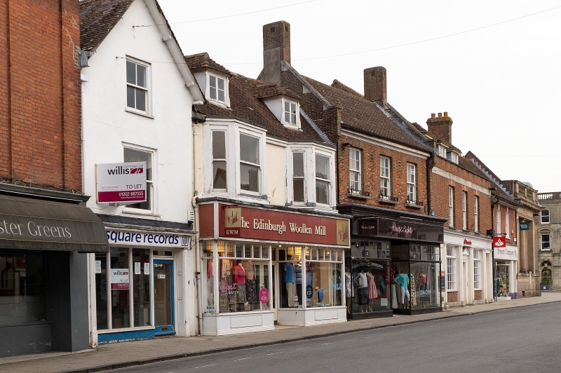
HIGH STREET
1.
5193
(west side)
No 12 (Curry's)
SU 0000 SE 2/55
II GV
2.
Appears C18 origin, altered C19. Rendered walls, tiled roof. Two storeys and attics.
Ground floor has modern shop front. First floor has 2 canted bay windows with flat
roofs, and double hung sashes. Attic has 2 dormers with hipped roofs and side hung
casements.
Included for group value.
Listing NGR: SU0094700007
External links are from the relevant listing authority and, where applicable, Wikidata. Wikidata IDs may be related buildings as well as this specific building. If you want to add or update a link, you will need to do so by editing the Wikidata entry.


Other nearby listed buildings
