Latitude: 50.7218 / 50°43'18"N
Longitude: -1.8782 / 1°52'41"W
OS Eastings: 408694
OS Northings: 91354
OS Grid: SZ086913
Mapcode National: GBR X76.ZP
Mapcode Global: FRA 67Y5.J44
Plus Code: 9C2WP4CC+PP
Entry Name: Granville Chambers
Listing Date: 1 August 1974
Grade: II
Source: Historic England
Source ID: 1153491
English Heritage Legacy ID: 101824
ID on this website: 101153491
Location: Bournemouth, Bournemouth, Christchurch and Poole, Dorset, BH1
County: Bournemouth, Christchurch and Poole
Parish: Bournemouth
Built-Up Area: Bournemouth
Traditional County: Hampshire
Lieutenancy Area (Ceremonial County): Dorset
Church of England Parish: Bournemouth Town Centre
Church of England Diocese: Winchester
Tagged with: Building
1. 5186 RICHMOND HILL (South-east Side] Granville Chambers SZ O891 13/128 1.8.74
II
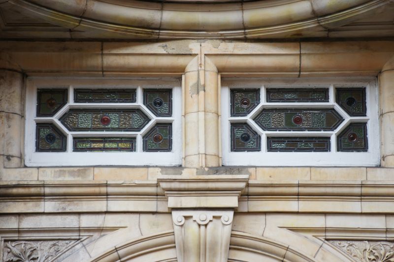
2. Franco-Flemish red brick and buff terracotta, c. 1885, 5 storeys and basement. Entrance on Yelverton Road flank under shell hood. Mullioned and transomed windows with 4-centred arched lights, framed by polygonal brick pilasters and terracotta cornices. 3-storey oriel to Yelverton Road, polygonal oriel on corner, 2-storey bay with rounded corners to Richmond Hill. Terracotta sculpture includes lions with swags in teeth under corner oriel, eagle corbel to chimneybreast, fern-like foliage in window spandrels. Fluted brackets to main cornice, 2 gables above it on Richmond Hill side, attic on corner altered. Iron railings to basement area, arched, on stepped brick plinth.
Listing NGR: SZ0869491354
External links are from the relevant listing authority and, where applicable, Wikidata. Wikidata IDs may be related buildings as well as this specific building. If you want to add or update a link, you will need to do so by editing the Wikidata entry.


Other nearby listed buildings