Approximate Location Map
Large Map »
Latitude: 51.6376 / 51°38'15"N
Longitude: -2.1574 / 2°9'26"W
OS Eastings: 389202
OS Northings: 193210
OS Grid: ST892932
Mapcode National: GBR 1P0.7DK
Mapcode Global: VH95K.K3BG
Plus Code: 9C3VJRQV+22
Entry Name: 28, Gumstool Hill
Listing Date: 6 September 1954
Grade: II
Source: Historic England
Source ID: 1153702
English Heritage Legacy ID: 128514
ID on this website: 101153702
Location: Tetbury, Cotswold, Gloucestershire, GL8
County: Gloucestershire
District: Cotswold
Civil Parish: Tetbury
Built-Up Area: Tetbury
Traditional County: Gloucestershire
Lieutenancy Area (Ceremonial County): Gloucestershire
Church of England Parish: Tetbury St Mary the Virgin
Church of England Diocese: Gloucester
Tagged with: Building
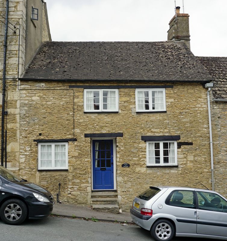
ST 8893-8993 TETBURY GUMSTOOL HILL
(west side)
7/240 No 28
6.9.54
GV II
Cottage in terrace. Late C17. Rubble stone, tile roof, rendered
brick stack to right. Single range. 2 storeys. 2 windows, 2-
light wood casements with continuous wood lintel on 1st floor.
Ground floor has 2 similar flanking central C20 glazed door in deep
reveal up 4 steps. Included for group value with Nos. 2-26 (even)
Gumstool Hill (q.v.).
Listing NGR: ST8920393210
External links are from the relevant listing authority and, where applicable, Wikidata. Wikidata IDs may be related buildings as well as this specific building. If you want to add or update a link, you will need to do so by editing the Wikidata entry.


Other nearby listed buildings
