Latitude: 51.8765 / 51°52'35"N
Longitude: -1.7245 / 1°43'28"W
OS Eastings: 419062
OS Northings: 219808
OS Grid: SP190198
Mapcode National: GBR 4QN.8TW
Mapcode Global: VHBZK.2359
Plus Code: 9C3WV7GG+J6
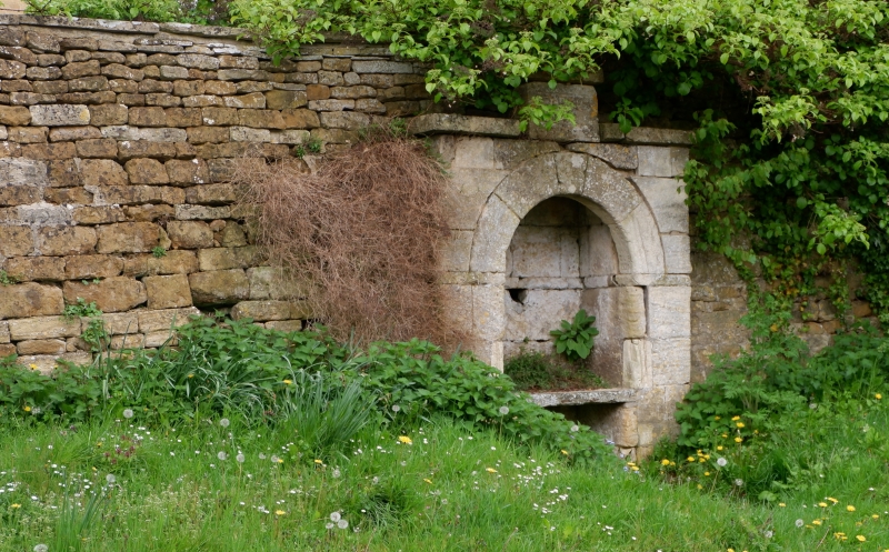
Entry Name: Surround to Water Conduit and Wall Opposite Hillside House
Listing Date: 28 May 1987
Grade: II
Source: Historic England
Source ID: 1153740
English Heritage Legacy ID: 130958
ID on this website: 101153740
Location: Little Rissington, Cotswold, Gloucestershire, GL54
County: Gloucestershire
District: Cotswold
Civil Parish: Little Rissington
Traditional County: Gloucestershire
Lieutenancy Area (Ceremonial County): Gloucestershire
Church of England Parish: Little Rissington St Peter
Church of England Diocese: Gloucester
Tagged with: Architectural structure
LITTLE RISSINGTON LITTLE RISSINGTON VILLAGE SP 1819-1919 8/227 Surround to water conduit and wall opposite Hillside House GV II Surround to water conduit set into wall. The former is dated and initialled 'D.E.F./1875' on a rectangular stone plaque over the recess, the wall is presumably of the same date. Surround to water conduit cream coloured ashlar. Wall coursed squared and dressed orange coloured limestone, c30m in length running from the 'bus stop around the corner to Hill House. Conduit surround set into wall c6m to the left of the gable end of Hill House. Surround to conduit; round-headed arched recess with imposts continued around the back of the recess. Former water source at rear now removed. Tank below water source also removed with a horizontal (bench- like) stone slab inserted in place. One of a pair of matching water sources (q.v. water conduit between Mullions and Bobble Farmhouse.
Listing NGR: SP1906219808
External links are from the relevant listing authority and, where applicable, Wikidata. Wikidata IDs may be related buildings as well as this specific building. If you want to add or update a link, you will need to do so by editing the Wikidata entry.


Other nearby listed buildings