Latitude: 51.4087 / 51°24'31"N
Longitude: -0.8359 / 0°50'9"W
OS Eastings: 481064
OS Northings: 168385
OS Grid: SU810683
Mapcode National: GBR C6D.RGH
Mapcode Global: VHDX2.GVGG
Plus Code: 9C3XC557+FM
Entry Name: The Crispin Public House
Listing Date: 2 October 1969
Grade: II
Source: Historic England
Source ID: 1154874
English Heritage Legacy ID: 41666
ID on this website: 101154874
Location: Wokingham, Berkshire, RG40
County: Wokingham
Civil Parish: Wokingham
Built-Up Area: Wokingham
Traditional County: Berkshire
Lieutenancy Area (Ceremonial County): Berkshire
Church of England Parish: Wokingham St Paul
Church of England Diocese: Oxford
Tagged with: Pub
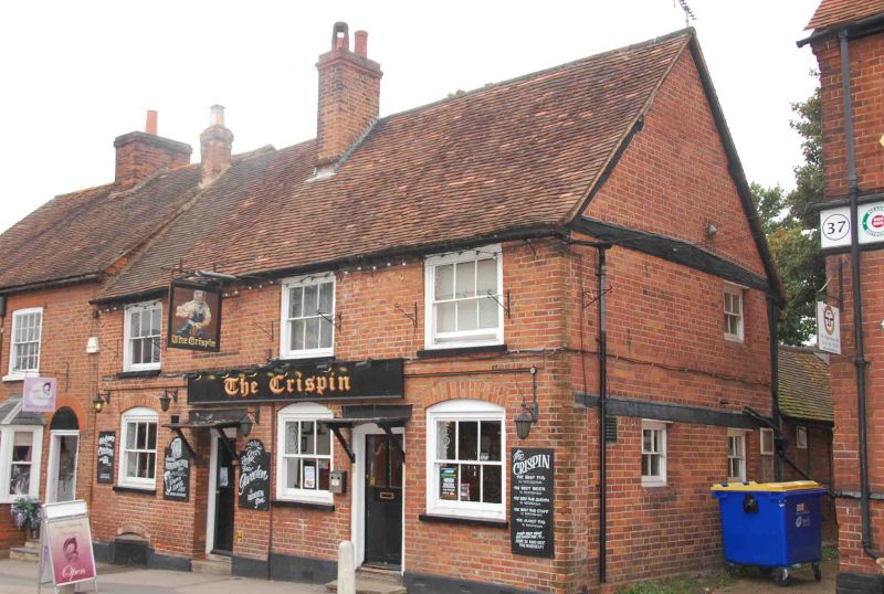
WOKINGHAM DENMARK STREET SU 8168 SW (West side) 2 19/10 Nos. 43 and 45 (The Crispin Public House) 2.10.69 G.Y. II Hall house, now public house. Early C16, altered mid C18, and mid C20. Timber framed encased in brick, some frame visible on north gable; old tile gabled roof. 3 framed bays, rear extensions. 2 storeys and cellar. Chimney to left of centre and just in front of ridge. Black painted projecting plinth, plat band at first floor. 3, first floor sash windows with glazing bars and architrave frames on road front, similar on ground floor but with segmental brick arch heads. Two, 4-panelled entrance doors, top panels glazed, between 1st and 2nd, and 2nd and 3rd ground floor windows; with small flat hoods. Semi-circular, brick arched delivery loading shute to cellar, on left. Interior:- most of the timber frame exposed on the first floor with jowled posts and wind braces.
Listing NGR: SU8106468385
External links are from the relevant listing authority and, where applicable, Wikidata. Wikidata IDs may be related buildings as well as this specific building. If you want to add or update a link, you will need to do so by editing the Wikidata entry.


Other nearby listed buildings