Approximate Location Map
Large Map »
Latitude: 55.0932 / 55°5'35"N
Longitude: -2.1943 / 2°11'39"W
OS Eastings: 387696
OS Northings: 577660
OS Grid: NY876776
Mapcode National: GBR F93K.Q0
Mapcode Global: WHB1R.87BT
Plus Code: 9C7V3RV4+77
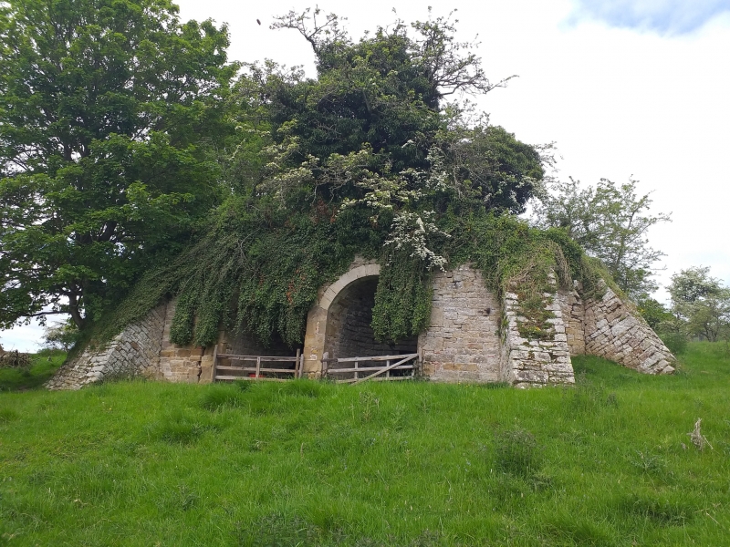
Entry Name: Limekiln C 300 Yards South of Birtley Hall
Listing Date: 10 November 1951
Last Amended: 5 September 1985
Grade: II
Source: Historic England
Source ID: 1155075
English Heritage Legacy ID: 239551
ID on this website: 101155075
Location: Birtley, Northumberland, NE48
County: Northumberland
Civil Parish: Birtley
Traditional County: Northumberland
Lieutenancy Area (Ceremonial County): Northumberland
Church of England Parish: Birtley St Giles
Church of England Diocese: Newcastle
Tagged with: Lime kiln
NY 87 NE BIRTLEY BIRTLEY VILLAGE
9/16 Limekiln c.300 yards
south of Birtley Hall
(Previously listed as:
Old Lime Kiln to South
of Birtley Castle)
10.11.51
II
Limekiln. C18 or early C19. Dressed stone. Two round arches flanked by
wing walls with 2 sloping buttresses on each side. Stone lime pot visible
and intact.
Listing NGR: NY8769677660
External links are from the relevant listing authority and, where applicable, Wikidata. Wikidata IDs may be related buildings as well as this specific building. If you want to add or update a link, you will need to do so by editing the Wikidata entry.


Other nearby listed buildings
