Latitude: 55.6713 / 55°40'16"N
Longitude: -1.7996 / 1°47'58"W
OS Eastings: 412700
OS Northings: 641994
OS Grid: NU127419
Mapcode National: GBR H2WV.5T
Mapcode Global: WHC05.BQ85
Plus Code: 9C7WM6C2+G4
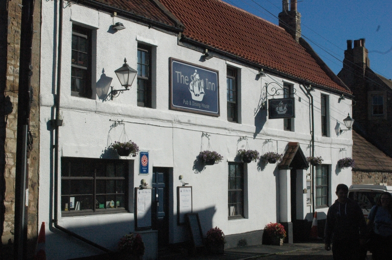
Entry Name: Northumberland Arms
Listing Date: 15 May 1986
Grade: II
Source: Historic England
Source ID: 1155506
English Heritage Legacy ID: 237740
Also known as: Ship
The Ship
ID on this website: 101155506
Location: Holy Island, Northumberland, TD15
County: Northumberland
Civil Parish: Holy Island
Traditional County: Northumberland
Lieutenancy Area (Ceremonial County): Northumberland
Church of England Parish: Holy Island St Mary the Virgin
Church of England Diocese: Newcastle
Tagged with: Pub
NU 1241 HOLY ISLAND MARYGATE (North side)
12/31 Northumberland Arms
GV II
Inn. C18. Rendered with old pantiled roof and rebuilt brick chimneys. 2 storeys, 3 bays, Central 5-panelled door with fanlight in open-pedimented doorcase. Flanking C20 12-pane sashes. Three 4-pane sashes on 1st floor. 1st floor sill band.
Steeply-pitched roof with swept eaves, and thin raised coping on right.
Listing NGR: NU1270041994
External links are from the relevant listing authority and, where applicable, Wikidata. Wikidata IDs may be related buildings as well as this specific building. If you want to add or update a link, you will need to do so by editing the Wikidata entry.


Other nearby listed buildings