Latitude: 51.5808 / 51°34'50"N
Longitude: -2.3368 / 2°20'12"W
OS Eastings: 376760
OS Northings: 186932
OS Grid: ST767869
Mapcode National: GBR 0N0.XP0
Mapcode Global: VH95N.GJ0J
Plus Code: 9C3VHMJ7+87
Entry Name: Church Farmhouse
Listing Date: 17 September 1952
Grade: II
Source: Historic England
Source ID: 1155615
English Heritage Legacy ID: 34310
ID on this website: 101155615
Location: Hawkesbury, South Gloucestershire, GL9
County: South Gloucestershire
Civil Parish: Hawkesbury
Traditional County: Gloucestershire
Lieutenancy Area (Ceremonial County): Gloucestershire
Church of England Parish: Hawkesbury St Mary
Church of England Diocese: Gloucester
Tagged with: Farmhouse
HAWKESBURY C.P. HAWKESBURY ST 78 NE 4/100 Church Farmhouse 17.9.52
G.V. II
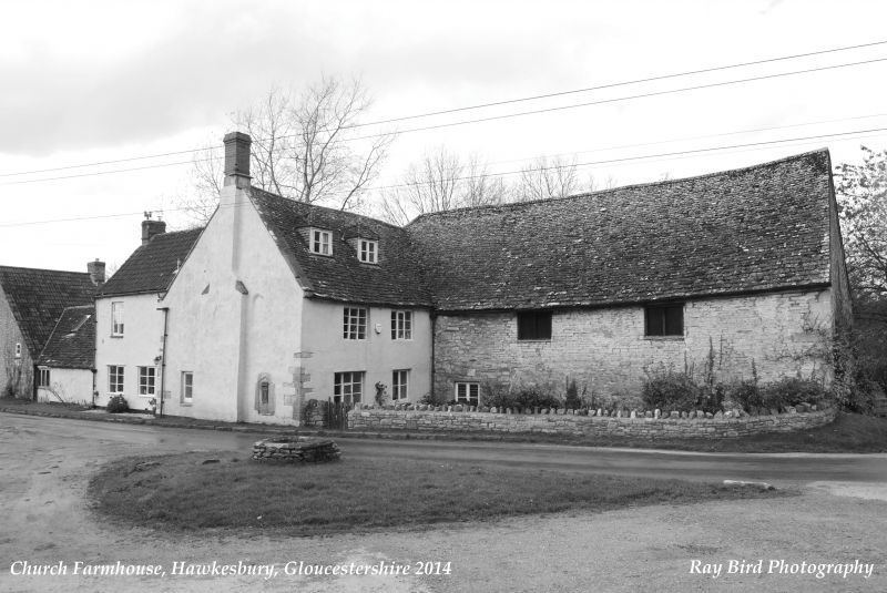
House. C16th, altered and restored 1980s. Rendered and rubble to north-east wings; Cotswold stone slate roof, some reproduction at rear and double Roman tiles to left. L plan with main north-east wing (formerly used as a malthouse), cross-wing to south east, and wing to south-west (late 18th/early C19th). 2 storeys. 3 windows and former door to main wing, 2 windows to cross wing and 2 windows and door to south-west wing; mostly 2- and 3-light C20th casements and doors; one 2-light casement with heavily chamfered mullion in north of main wing and one 3-light casement of c.1700 with scroll moulded mullions and decorative catch on cross-wing, the gable end of cross wing has a projecting stack and 2 blocked single light windows with depressed 4-centred heads (the lower one has incised lines above the head which might be the guidelines for spandrels). Interior: 5 chamfered beams to main range with stop chamfered joists between; roof, 4 tie-beam trusses with tenoned collars and 2 pairs of purlins (probably formerly windbraced) to main wing and 4 tie-and-collar beam trusses with 2 pairs of purlins and formerly 2 tiers of curved windbraces (a few remain) to cross wing. Hall, L, The Rural Houses of Northavon and south Gloucestershire, 1983.
Listing NGR: ST7675886933
External links are from the relevant listing authority and, where applicable, Wikidata. Wikidata IDs may be related buildings as well as this specific building. If you want to add or update a link, you will need to do so by editing the Wikidata entry.


Other nearby listed buildings