Latitude: 51.6935 / 51°41'36"N
Longitude: -1.6897 / 1°41'22"W
OS Eastings: 421547
OS Northings: 199464
OS Grid: SU215994
Mapcode National: GBR 4ST.ZJS
Mapcode Global: VHC0B.NPLM
Plus Code: 9C3WM8V6+C4
Entry Name: Church House, with Gatepiers, Gate and Railings
Listing Date: 4 June 1952
Grade: II
Source: Historic England
Source ID: 1155733
English Heritage Legacy ID: 128995
ID on this website: 101155733
Location: Lechlade-on-Thames, Cotswold, Gloucestershire, GL7
County: Gloucestershire
District: Cotswold
Civil Parish: Lechlade
Built-Up Area: Lechlade-on-Thames
Traditional County: Gloucestershire
Lieutenancy Area (Ceremonial County): Gloucestershire
Church of England Parish: Lechlade St Lawrence
Church of England Diocese: Gloucester
Tagged with: Architectural structure
SU 2199 LECHLADE CHURCH WALK (south side)
10/150 Church House, with gatepiers, gate and railings to north
4.6.52
GV II
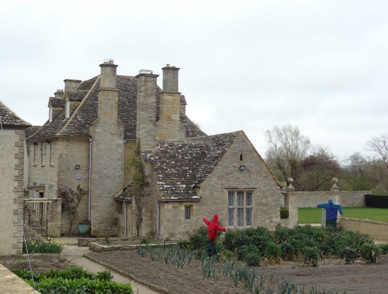
Large town house. Core probably of late C17, refronted and enlarged early C18. Rubble stone with alternating chamfered quoins, hipped stone slate roof with moulded wood eaves cornice, 4 tall stone external stacks to main range with single ashlar flues with moulded cornices. Main central square range of 2 storeys and attic with flanking wings built post World War 1 in similar materials. Three windows to north entrance front, 12-pane sashes with timber lintels. Two similar on ground floor with central moulded stone square doorcase with large flat wooden hood on brackets and door of 2 large recessed panels. Two gabled dormers with projecting wooden cornices and paired 6-pane wooden casements. Twelve-pane sash to left of back door on south side has original glazing bars, door has flat wooden hood on scrolled brackets. Interior not accessible but likely to be of interest. Gatepiers to north of ashlar on moulded plinth, with indented corners, plain frieze, wide moulded cornice and large stone ball finial on 3-step base, about 3m total height. Wrought iron gate between and matching railings to each side on coped coursed rubble stone wall, probably of late C19 or early C20. At the back of the house is a large rectangular fish pond with sloping banks probably the remains of a formal garden of C18, and to the south east of the house the remains of one of the village wharves, originally open to the Thames, excavated and partly re-walled in late C20.
Listing NGR: SU2154799464
External links are from the relevant listing authority and, where applicable, Wikidata. Wikidata IDs may be related buildings as well as this specific building. If you want to add or update a link, you will need to do so by editing the Wikidata entry.


Other nearby listed buildings