Latitude: 51.0919 / 51°5'30"N
Longitude: -1.1615 / 1°9'41"W
OS Eastings: 458820
OS Northings: 132841
OS Grid: SU588328
Mapcode National: GBR 976.F5Z
Mapcode Global: FRA 86G7.FBH
Plus Code: 9C3W3RRQ+PC
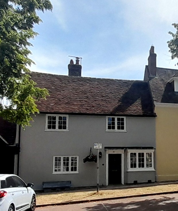
Entry Name: 44, Broad Street
Listing Date: 5 December 1955
Grade: II
Source: Historic England
Source ID: 1155923
English Heritage Legacy ID: 145076
ID on this website: 101155923
Location: New Alresford, Winchester, Hampshire, SO24
County: Hampshire
District: Winchester
Civil Parish: New Alresford
Built-Up Area: New Alresford
Traditional County: Hampshire
Lieutenancy Area (Ceremonial County): Hampshire
Church of England Parish: New Alresford St John the Baptist
Church of England Diocese: Winchester
Tagged with: Building
SU 5832 NEW ALRESFORD BROAD STREET (East Side) 13/62 No 44 5.12.55 GV II
House. C18. Stucco, with a tile roof. 2 storeys, 2 windows. Casements, one C19 small rectangular bay at the south side. Doorcase with moulded canopy on carved brackets, and 2-panelled (boarded) door.
Listing NGR: SU5882232843
External links are from the relevant listing authority and, where applicable, Wikidata. Wikidata IDs may be related buildings as well as this specific building. If you want to add or update a link, you will need to do so by editing the Wikidata entry.


Other nearby listed buildings