Latitude: 51.4623 / 51°27'44"N
Longitude: -2.3202 / 2°19'12"W
OS Eastings: 377849
OS Northings: 173748
OS Grid: ST778737
Mapcode National: GBR 0PL.86Z
Mapcode Global: VH967.QHRW
Plus Code: 9C3VFM6H+WW
Entry Name: 68, High Street
Listing Date: 17 September 1952
Grade: II
Source: Historic England
Source ID: 1156895
English Heritage Legacy ID: 34504
ID on this website: 101156895
Location: Marshfield, South Gloucestershire, SN14
County: South Gloucestershire
Civil Parish: Marshfield
Built-Up Area: Marshfield
Traditional County: Gloucestershire
Lieutenancy Area (Ceremonial County): Gloucestershire
Church of England Parish: Marshfield
Church of England Diocese: Bristol
Tagged with: Building
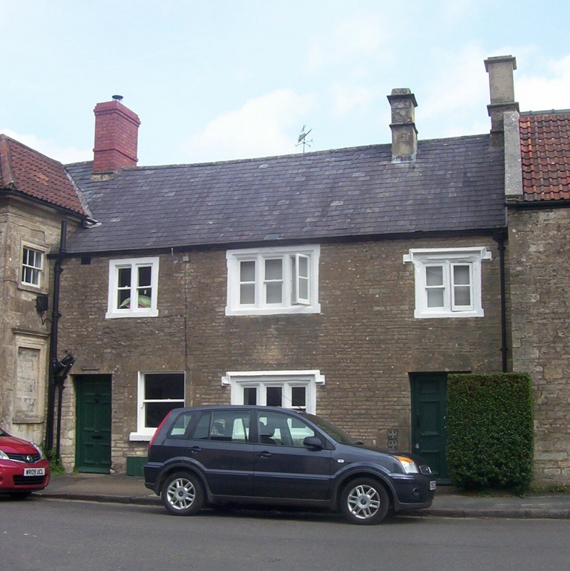
MARSHFIELD C.P. HIGH STREET (north side)
ST 7773
13/91 No. 68
17.9.52
G.V. II
House in the village street. Late C17, altered C19. Coursed rubble; slate
roof. 2 storeys. 2 windows and outer doors on ground floor; 3 windows on
first floor, 2- and 3-light casement windows with ovolo moulded mullions and
surrounds, 2 under drip moulds. 6 panel doors.
Listing NGR: ST7784973748
External links are from the relevant listing authority and, where applicable, Wikidata. Wikidata IDs may be related buildings as well as this specific building. If you want to add or update a link, you will need to do so by editing the Wikidata entry.


Other nearby listed buildings