Latitude: 51.4622 / 51°27'43"N
Longitude: -2.3223 / 2°19'20"W
OS Eastings: 377703
OS Northings: 173737
OS Grid: ST777737
Mapcode National: GBR 0PL.7P9
Mapcode Global: VH967.PHMY
Plus Code: 9C3VFM6H+V3
Entry Name: 93, High Street
Listing Date: 17 September 1952
Grade: II
Source: Historic England
Source ID: 1157011
English Heritage Legacy ID: 34553
ID on this website: 101157011
Location: Marshfield, South Gloucestershire, SN14
County: South Gloucestershire
Civil Parish: Marshfield
Built-Up Area: Marshfield
Traditional County: Gloucestershire
Lieutenancy Area (Ceremonial County): Gloucestershire
Church of England Parish: Marshfield
Church of England Diocese: Bristol
Tagged with: Building
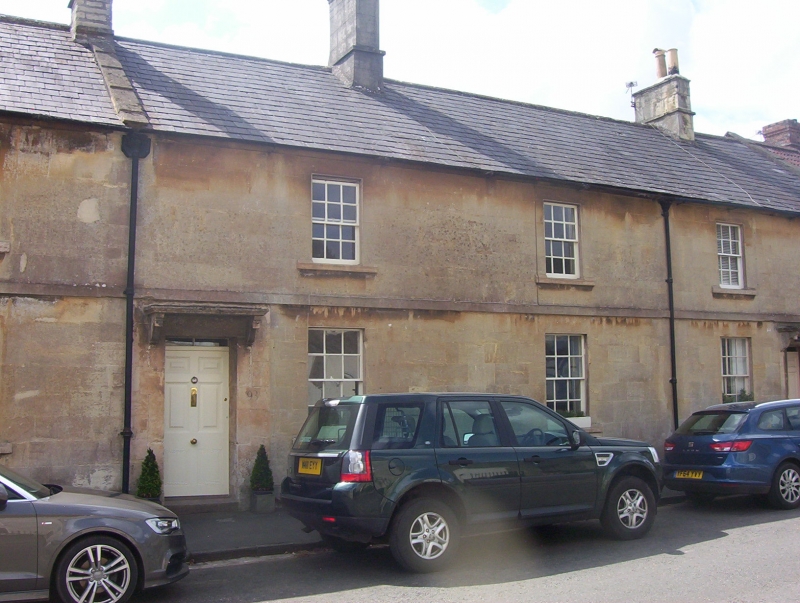
MARSHFIELD C.P. HIGH STREET (south side)
ST 7773
13/140 No. 93
17.9.52
G.V. II
House in the village street. Early C19. Ashlar; slate roof with coped raised
verge. 2 storeys with plain band over ground floor. 2 glazing bar sash windows.
6 panel door off-centre to left, under overlight and flat stone on brackets.
Listing NGR: ST7770373737
External links are from the relevant listing authority and, where applicable, Wikidata. Wikidata IDs may be related buildings as well as this specific building. If you want to add or update a link, you will need to do so by editing the Wikidata entry.


Other nearby listed buildings