Approximate Location Map
Large Map »
Latitude: 51.3377 / 51°20'15"N
Longitude: -1.3239 / 1°19'26"W
OS Eastings: 447191
OS Northings: 160060
OS Grid: SU471600
Mapcode National: GBR 82R.23P
Mapcode Global: VHCZR.0MFW
Plus Code: 9C3W8MQG+3C
Entry Name: Dodds Farmhouse
Listing Date: 18 May 1984
Grade: II
Source: Historic England
Source ID: 1157579
English Heritage Legacy ID: 138055
ID on this website: 101157579
Location: Basingstoke and Deane, Hampshire, RG20
County: Hampshire
District: Basingstoke and Deane
Civil Parish: Burghclere
Traditional County: Hampshire
Lieutenancy Area (Ceremonial County): Hampshire
Church of England Parish: Burghclere with Newtown
Church of England Diocese: Winchester
Tagged with: Farmhouse
SU 46 SE BURGHCLERE WELL STREET
2/44
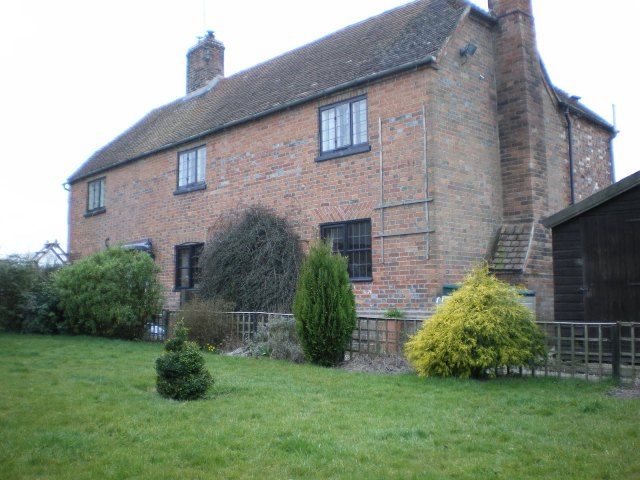
Dodds Farmhouse
II
Cl8. Two storeys, 3 windows. Half-hipped tile roof. Walling of brickwork in Flemish
bond with blue headers, rubbed flat arches to the ground-floor, plinth. Casements.
Plain door, beneath a hood on brackets.
Listing NGR: SU4719160060
External links are from the relevant listing authority and, where applicable, Wikidata. Wikidata IDs may be related buildings as well as this specific building. If you want to add or update a link, you will need to do so by editing the Wikidata entry.


Other nearby listed buildings
