Latitude: 52.088 / 52°5'16"N
Longitude: -1.8994 / 1°53'57"W
OS Eastings: 406989
OS Northings: 243295
OS Grid: SP069432
Mapcode National: GBR 3LL.0M0
Mapcode Global: VHB0V.1S67
Plus Code: 9C4W34Q2+56
Entry Name: 18 High Street
Listing Date: 30 July 1959
Last Amended: 9 January 1987
Grade: II
Source: Historic England
Source ID: 1157646
English Heritage Legacy ID: 148615
ID on this website: 101157646
Location: Badsey, Wychavon, Worcestershire, WR11
County: Worcestershire
District: Wychavon
Civil Parish: Badsey
Built-Up Area: Badsey
Traditional County: Worcestershire
Lieutenancy Area (Ceremonial County): Worcestershire
Church of England Parish: Badsey with Aldington
Church of England Diocese: Worcester
Tagged with: Building
This list entry was subject to a Minor Amendment on 3 April 2025 to amend details in the description and to reformat the text to current standards
SP 0643 - SP 0743
14/13
BADSEY CP
HIGH STREET (west side)
No 18
(Formerly listed as Sumach Bakery)
30.7.59
GV
II
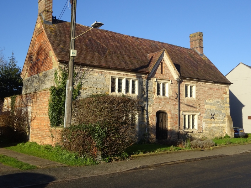
House. C17, remodelled c. 1857. Coursed rubble with ashlar quoins, partly rebuilt in brick and faced in roughcast. Tile roof; gable-end stacks. Two storeys; three windows, central one under a gablet, of four lights to left and two lights, all stone mullioned. Ground floor a four-light stone mullioned window to left, three-light to right, both with square labels. Central entrance has a C19 ledged and boarded door. Datestone in left-hand-gable.
Listing NGR: SP0698943295
External links are from the relevant listing authority and, where applicable, Wikidata. Wikidata IDs may be related buildings as well as this specific building. If you want to add or update a link, you will need to do so by editing the Wikidata entry.


Other nearby listed buildings