Latitude: 52.1366 / 52°8'11"N
Longitude: -1.9198 / 1°55'11"W
OS Eastings: 405585
OS Northings: 248702
OS Grid: SP055487
Mapcode National: GBR 3KZ.1GB
Mapcode Global: VHB0M.NKYF
Plus Code: 9C4W43PJ+J3
Entry Name: The Laurels
Listing Date: 9 January 1987
Grade: II
Source: Historic England
Source ID: 1157840
English Heritage Legacy ID: 148680
ID on this website: 101157840
Location: Harvington, Wychavon, Worcestershire, WR11
County: Worcestershire
District: Wychavon
Civil Parish: Harvington
Built-Up Area: Harvington
Traditional County: Worcestershire
Lieutenancy Area (Ceremonial County): Worcestershire
Church of England Parish: Harvington
Church of England Diocese: Worcester
Tagged with: Architectural structure
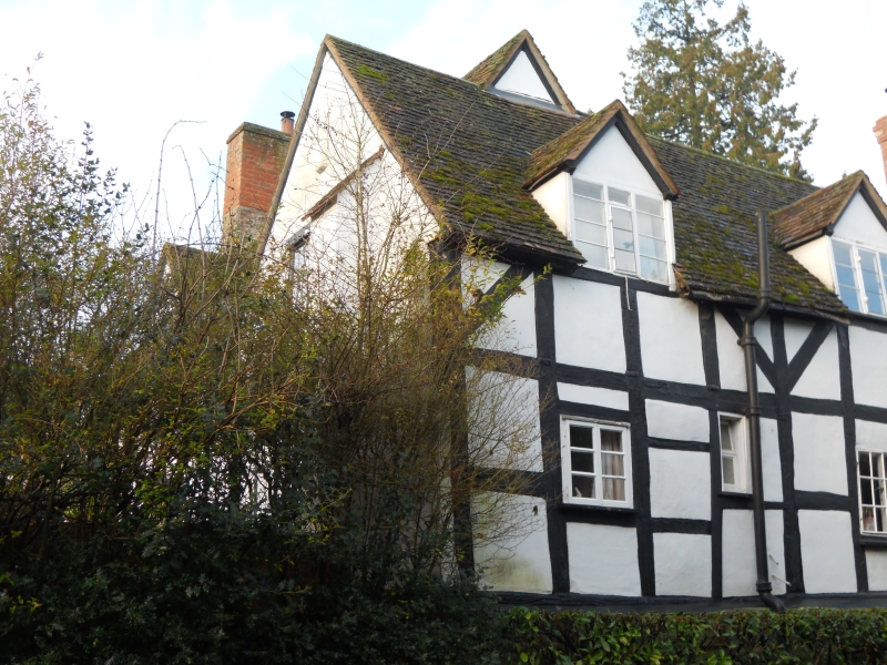
HARVINGTON CP CHURCH STREET (west side)
SP 0448 - SP 0548
10/77 The Laurels
GV II
House. C17, extended early C19 with some late C20 alterations. Timber-framed
with rendered infill on stone plinth with machine tile and slate roof. L-plan,
with range extending to north and west, C19 addition to north. East front: one
storey with attic, lit by two gabled dormers over two casements to left; to right
C19 addition with hipped roof and three glazing bar sashes. Main entrance in
left-hand return wall.
Listing NGR: SP0558548702
External links are from the relevant listing authority and, where applicable, Wikidata. Wikidata IDs may be related buildings as well as this specific building. If you want to add or update a link, you will need to do so by editing the Wikidata entry.


Other nearby listed buildings